
Near Trezevant in Carroll County, Tennessee — The American South (East South Central)
Christmasville
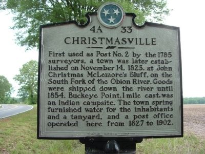
Photographed by Ken Smith, May 9, 2009
1. Christmasville Marker
Erected 1977 by Tennessee Historical Commission. (Marker Number 4A 33.)
Topics and series. This historical marker is listed in this topic list: Settlements & Settlers. In addition, it is included in the Tennessee Historical Commission series list. A significant historical month for this entry is November 1932.
Location. 36° 4.231′ N, 88° 36.737′ W. Marker is near Trezevant, Tennessee, in Carroll County. It is on Tennessee Route 190 at milepost 4, 0.3 miles south of Hinkledale Road, on the right when traveling north. Touch for map. Marker is at or near this postal address: 4082 Hwy 190, Trezevant TN 38258, United States of America. Touch for directions.

Regionally, this marker is in West Tennessee. It is also in the American South and specifically
this page online
Other nearby markers. At least 8 other markers are within 7 miles of this marker, measured as the crow flies: Hillsman House (approx. 3.3 miles away); Trezevant Veterans Memorial (approx. 4.1 miles away); Forrest's Raid (approx. 5.8 miles away); Bethel College (approx. 6 miles away); Reedy Creek Missionary Baptist Church (approx. 6 miles away); Rev. John Neal Roach (approx. 6 miles away); McLemoresville United Methodist Church (approx. 6 miles away); First County Court (approx. 6.1 miles away). Touch for a list and map of all markers in Trezevant.
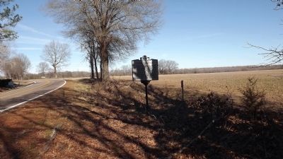
Photographed by Ken Smith, February 2, 2012
2. Christmasville Marker
This is the current location for the marker. It was originally, approximately 2 miles north of this location, in a "Y" of the road.
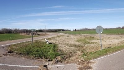
Photographed by Ken Smith, February 2, 2012
3. Originally Location of Christmasville Marker
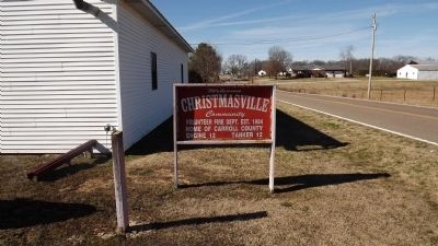
Photographed by Ken Smith, February 2, 2012
4. Christmasville Community
Credits. This page was last revised on June 16, 2016. It was originally submitted on February 2, 2012, by Ken Smith of Milan, Tennessee. This page has been viewed 1,782 times since then and 82 times this year. Photos: 1, 2, 3, 4. submitted on February 2, 2012, by Ken Smith of Milan, Tennessee. • Bernard Fisher was the editor who published this page.
