Edenvale in San Jose in Santa Clara County, California — The American West (Pacific Coastal)
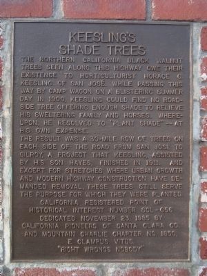
Keesling’s Shade Trees
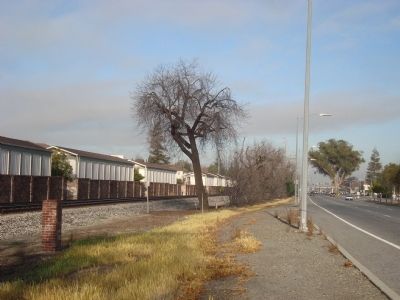
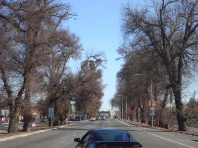
The result was a 30-mile row of trees on each side of the road from San José to Gilroy, a project that Keesling, assisted by his son Hayes, finished in 1911. And except for stretches where urban growth and modern highway construction have demanded removal, these trees still serve the purpose for which they were planted.
Erected 1985 by California Pioneers of Santa Clara County and E Clampus Vitus, Mountain Charlie Chapter No. 1850. (Marker Number SCL-056.)
Topics and series. This historical marker is listed in this topic list: Horticulture & Forestry. In addition, it is included in the E Clampus Vitus, and the Historic Trees series lists. A significant historical year for this entry is 1900.
Location. 37° 16.388′ N, 121° 49.826′ W. Marker is in San Jose, California, in Santa Clara County. It is in Edenvale. Marker is on Monterey Road (California Route 82) just north of Skyway Drive, on the right when traveling south. This marker is located between Monterey Road and the Southern Pacific Railroad tracks. Touch for map. Marker is in this post office area: San Jose CA 95111, United States of America. Touch for directions.
Other nearby markers. At least 8 other markers are within 3 miles of this marker, measured as the crow flies. Frontier Village (approx. 0.7 miles away); Hayes Mansion (approx. 0.9 miles away); a different marker also named Hayes Mansion (approx. 0.9 miles away); History of Vieira Park (approx. 2 miles away); IBM Building 025 (approx. 2.1 miles away); George Donner, Jr. (approx. 2.2 miles away); Dr. John Townsend (approx. 2.3 miles away); Jean Jacques Vioget (approx. 2.3 miles away). Touch for a list and map of all markers in San Jose.
Credits. This page was last revised on February 7, 2023. It was originally submitted on February 2, 2012, by Barry Swackhamer of Brentwood, California. This page has been viewed 1,332 times since then and 83 times this year. Photos: 1, 2, 3. submitted on February 2, 2012, by Barry Swackhamer of Brentwood, California. • Syd Whittle was the editor who published this page.


