Liberty in Pickens County, South Carolina — The American South (South Atlantic)
St. Luke's Methodist Episcopal Church & Cemetery
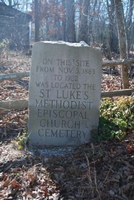
Inscription.
From Nov. 3, 1883
To 1922
Was Located the
St. Luke's
Methodist
Episcopal
Church &
Cemetery
Topics. This historical marker is listed in these topic lists: Cemeteries & Burial Sites • Churches & Religion. A significant historical date for this entry is October 3, 1883.
Location. 34° 45.367′ N, 82° 38.633′ W. Marker is in Liberty, South Carolina, in Pickens County. Marker is on Flat Rock Road north of Anderson Highway (South Carolina Highway 135). Touch for map. Marker is in this post office area: Liberty SC 29657, United States of America. Touch for directions.
Other nearby markers. At least 10 other markers are within 6 miles of this marker, measured as the crow flies. Soldiers Buried in Carmel Cemetery (about 800 feet away, measured in a direct line); John C. Calhoun Memorial Highway (approx. 2.6 miles away); Pickens Cemetery (approx. 3.2 miles away); Veterans Service Station (approx. 3.4 miles away); World War Veterans Monument (approx. 3.4 miles away); Pickensville (approx. 4˝ miles away); Mt. Pisgah Baptist Church (approx. 4.7 miles away); Golden Creek Mill (approx. 4.8 miles away); Julien D. Wyatt (approx. 5˝ miles away); Colonel Robert Elliott Holcombe (approx. 5˝ miles away). Touch for a list and map of all markers in Liberty.
Additional commentary.
1. St. Luke Methodist Episcopal Church
St. Luke Methodist Episcopal Church, located on what is now Flat Rock School Road near Five Forks Intersection, was begun November 3, 1883. The land was sold to the congregation on November 27, 1887, with Benson Hallums, Gilbert Blassingame, and Cary Pickens as trustees. Benson Hallums sold the one acre "on the road leading from Five Forks to a Brick Church named Carmel," for fifteen dollars to the trustees.
The Church, situated on a 1.8 acre tract, thrived and prospered for a number of years. The departure of many members from rural areas to the towns and cities, together with deaths of the members, decreased the congregation. The church closed in 1922.
A longtime pastor of the church was the Rev. Tillman. Families who maintained membership during St. Luke's existence included the Hallums Family, Blassingame Family, Edmond Welborn, Ann Welborn Family, Boggs Family, Reid Family, and Simpson Family.
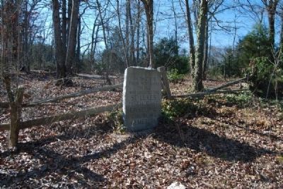
The site of St. Luke Church is maintained. It is a weeded area with a cemetery marked only by some field rocks. A granite marker on Flat Rock Road recognizes the former church and its contribution to the community.
— Submitted February 4, 2012, by Brian Scott of Anderson, South Carolina.
Credits. This page was last revised on June 16, 2016. It was originally submitted on February 4, 2012, by Brian Scott of Anderson, South Carolina. This page has been viewed 696 times since then and 37 times this year. Photos: 1, 2. submitted on February 4, 2012, by Brian Scott of Anderson, South Carolina.

