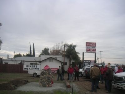
Madera in Madera County, California — The American West (Pacific Coastal)
Madera
Spanish for "Lumber", The First Industry
Inscription.
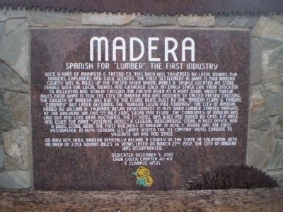
Once a part of Mariposa and Fresno Co, this area was traversed by local Indians, fur traders, explorers and gold seekers. The first settlement in what is now Madera County was 16 miles up the Fresno River where James D. Savage located his store, traded with local Indians and gathered gold. An early stage line from Stockton to Millerton and Visalia crossed the Fresno River at a point down, about twelve miles from what is now the City of Madera and was another so called Fresno Crossing. The growth of Madera was due to the flume being built by the "Madera Flume and Trading Company" but later becoming the "Madera Sugar Pine Company". The city of Madera, named by William H. Thurman, began development in 1875 when lumber started arriving at the railhead via this 55 mile long Sugar Pine Flume. The community of Madera was laid out and lots were auctioned. The 1st hotel was built and owned by Cptn. R. P. Mace and given the name "Yosemite Hotel", a general merchandise store, a Post Office and drug store were the first buildings in Madera. In 1878, E. Moore was the first Postmaster. In 1879, General U.S. Grant visited the "El Capitan" Hotel enroute to Yosemite via rail and stage.
On May 16th, 1893 Madera officially became a county of the State of California, with an area of 2,153 square miles. 14 years later on March 27th, 1907, the city of Madera was incorporated.
Erected 2010 by E Clampus Vitus, Grub Gulch chapter 41-49.
Topics and series. This historical marker is listed in these topic lists: Industry & Commerce • Settlements & Settlers. In addition, it is included in the E Clampus Vitus, and the Former U.S. Presidents: #18 Ulysses S. Grant series lists. A significant historical month for this entry is March 1897.
Location. 36° 59.667′ N, 120° 0.156′ W. Marker is in Madera, California, in Madera County. Marker is at the intersection of Highway 145 and Road 400, on the right when traveling west on Highway 145. Marker is just to the South of the Tackle Box Too on Highway 145. Touch for map. Marker is at or near this postal address: 29849 California 145, Madera CA 93638, United States of America. Touch for directions.
Other nearby markers. At least 8 other markers are within 12 miles of this marker, measured as the crow flies. Madera to Yosemite Stage Route (approx. 3.9 miles away); Madera Zoo (approx. 4 miles away); Madera County Library Service (approx. 4 miles away); Borden Chinese Cemetery (approx. 5.2 miles away); a different marker also named Borden Chinese Cemetery (approx. 5.2 miles away); Berenda (approx. 8.9 miles away); Dixieland School (approx. 11.2 miles away); Mammoth Orange (approx. 11˝ miles away). Touch for a list and map of all markers in Madera.
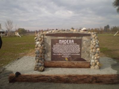
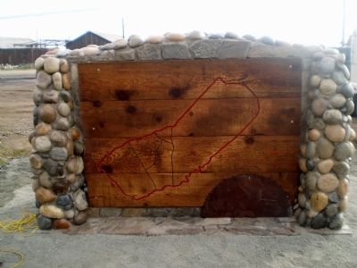
More about this marker. The marker incorporates 2 old saws into its design. At the top is an old cross-cut saw, and built into the base, and old circular saw blade is seen cutting through a log, a direct reference to the name of the town, the Spanish word for lumber.
Credits. This page was last revised on June 16, 2016. It was originally submitted on February 5, 2012, by Lester J Letson of Fresno, California. This page has been viewed 918 times since then and 30 times this year. Photos: 1, 2, 3, 4, 5. submitted on February 5, 2012, by Lester J Letson of Fresno, California. • Syd Whittle was the editor who published this page.
