Allegheny Township near Duncansville in Blair County, Pennsylvania — The American Northeast (Mid-Atlantic)
Blair Homestead
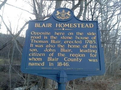
Photographed by Mike Wintermantel, February 6, 2012
1. Blair Homestead Marker
Erected 1947 by Pennsylvania Historical and Museum Commission.
Topics and series. This historical marker is listed in these topic lists: Government & Politics • Settlements & Settlers. In addition, it is included in the Pennsylvania Historical and Museum Commission (PHMC) series list. A significant historical year for this entry is 1785.
Location. 40° 24.877′ N, 78° 27.767′ W. Marker is near Duncansville, Pennsylvania, in Blair County. It is in Allegheny Township. It is at the intersection of Foot of Ten Road and Willowbridge Lane, on the right when traveling east on Foot of Ten Road. Touch for map. Marker is at or near this postal address: 1220 Foot of Ten Rd, Duncansville PA 16635, United States of America. Touch for directions.

Regionally, this marker is in the American Northeast, in the Mid-Atlantic, in Appalachia, and specifically in Northern Appalachia. Globally, it is in North America, the
this page online
Other nearby markers. At least 8 other markers are within 4 miles of this marker, measured as the crow flies: Staying Alive (approx. 0.2 miles away); Making the Connection (approx. half a mile away); Fort Fetter (approx. 2.8 miles away); Hiding Incline 8 (approx. 3.4 miles away); Jaycee Memorial Park (approx. 3.6 miles away); Canal Basin (approx. 3.6 miles away); Adam Holliday (approx. 3.7 miles away); First High School (approx. 3.8 miles away). Touch for a list and map of all markers in Duncansville.
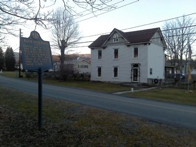
Photographed by Mike Wintermantel, February 6, 2012
2. Blair Homestead Marker
Credits. This page was last revised on February 7, 2023. It was originally submitted on February 6, 2012, by Mike Wintermantel of Pittsburgh, Pennsylvania. This page has been viewed 1,906 times since then and 55 times this year. Photos: 1, 2. submitted on February 6, 2012, by Mike Wintermantel of Pittsburgh, Pennsylvania.
