Logan Township near Altoona in Blair County, Pennsylvania — The American Northeast (Mid-Atlantic)
Horseshoe Curve
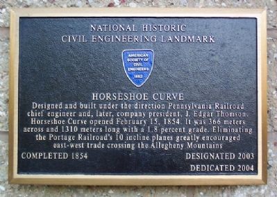
National Historic Engineering Landmark
Photographed by William Fischer, Jr., July 6, 2009
1. Horseshoe Curve NHCEL Marker
Designed and built under the direction [of] Pennsylvania Railroad chief engineer and, later, company president, J. Edgar Thomson. Horseshoe Curve opened February 15, 1854. It was 366 meters across and 1310 meters long with a 1.8 percent grade. Eliminating the Portage Railroad's 10 incline planes greatly encouraged east-west trade crossing the Allegheny Mountains.
Completed 1854 • Designated 2003
Erected 2004 by American Society of Civil Engineers.
Topics and series. This historical marker is listed in these topic lists: Industry & Commerce • Landmarks • Man-Made Features • Railroads & Streetcars. In addition, it is included in the ASCE Civil Engineering Landmarks, and the Pennsylvania Railroad (PRR) series lists. A significant historical date for this entry is February 15, 1790.
Location. 40° 29.858′ N, 78° 29.068′ W. Marker is near Altoona, Pennsylvania, in Blair County. It is in Logan Township. It is on Veterans Memorial Highway, on the right when traveling west. Touch for map. Marker is at or near this postal address: 2400 Veterans Memorial Hwy, Altoona PA 16601, United States of America. Touch for directions.

Regionally,
this page online
Other nearby markers. At least 8 other markers are within 4 miles of this marker, measured as the crow flies: A different marker also named Horseshoe Curve (a few steps from this marker); The GP9 (about 400 feet away, measured in a direct line); Trackside Buildings (about 400 feet away); Over the Hill (about 400 feet away); Watching The Curve (about 600 feet away); Blair County War Mothers Memorial (approx. 3.3 miles away); Blair County Memorial Highway (approx. 3.3 miles away); Endress War Memorial (approx. 3.3 miles away). Touch for a list and map of all markers in Altoona.
Also see . . .
1. Horseshoe Curve. Wikipedia entry (Submitted on February 11, 2012, by William Fischer, Jr. of Reynoldsburg, Ohio.)
2. World Famous Horseshoe Curve. Railroaders Memorial
Photographed by William Fischer, Jr., July 6, 2009
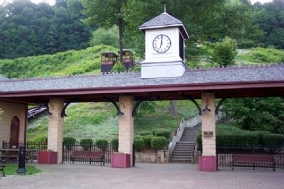
2. Horseshoe Curve NHCEL Marker
Steps and funicular to viewing area are seen in background
Photographed by William Fischer, Jr., July 6, 2009
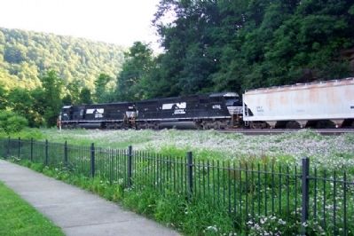
3. Norfolk Southern Freight Rounds Horseshoe Curve
Photographed by William Fischer, Jr., July 6, 2009
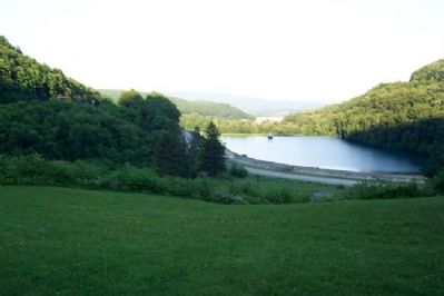
4. View East From Horseshoe Curve
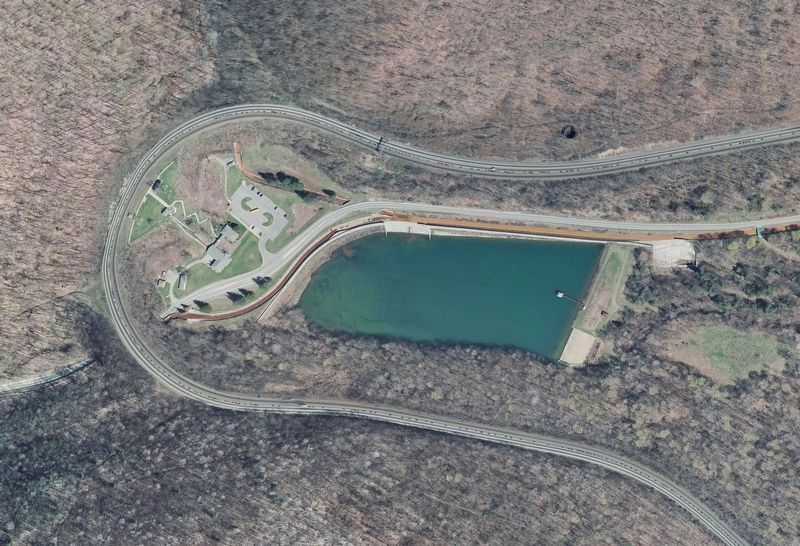
Photographed by U.S. Geological Survey, March 1, 2006
5. Orthoimage of the Horseshoe Curve
Wikipedia description: “Trains headed counterclockwise around the curve are ascending. The visitor center and observation park are at the apex of the curve, and a reservoir is located in the valley spanned by it.”
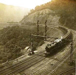
Photographed by H.C. White Co. Stereograph Print, circa 1907
6. The Horseshoe Curve, Pennsylvania.
From the Robert N. Dennis collection of stereoscopic view at the New York Public Library Division of Art, Prints and Photographs, via Wikipedia Commons.
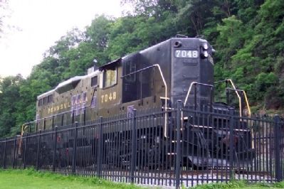
Photographed by William Fischer, Jr., July 6, 2009
7. Diesel on Display at Horseshoe Curve
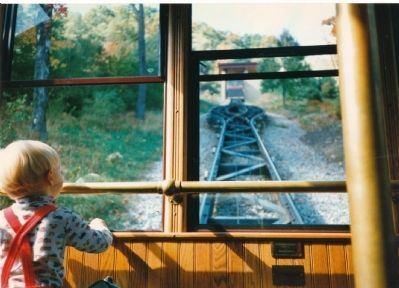
Photographed by Anton Schwarzmueller, October 14, 1996
8. Funicular Car at Horseshoe Curve
Riding the funicular up to trackside at Horseshoe Curve.
Credits. This page was last revised on November 12, 2023. It was originally submitted on February 11, 2012, by William Fischer, Jr. of Reynoldsburg, Ohio. This page has been viewed 2,503 times since then and 123 times this year. It was the Marker of the Week February 17, 2019. Photos: 1, 2, 3, 4. submitted on February 11, 2012, by William Fischer, Jr. of Reynoldsburg, Ohio. 5, 6. submitted on February 16, 2019, by J. J. Prats of Powell, Ohio. 7. submitted on February 11, 2012, by William Fischer, Jr. of Reynoldsburg, Ohio. 8. submitted on October 1, 2014, by Anton Schwarzmueller of Wilson, New York.
