Downtown San Jose in Santa Clara County, California — The American West (Pacific Coastal)
St. James Park
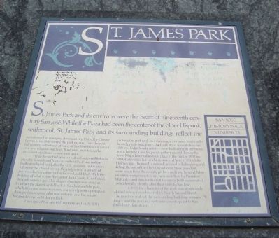
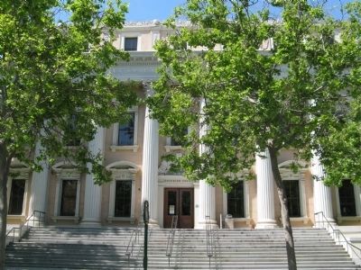
While the site had been considered as a possible future plaza by Spanish and Mexican authorities, it was not formally developed until after the U.S. takeover. In the years following the official survey, the park served a variety of purposed but remained unlandscaped until 1868. With the building of what is now the Santa Clara County Courthouse, the park came of age. This elegant structure was designed to attract the State Capital back to San Jose and the park which it fronted, was envisioned as a grand public open space. A major landscaping plan initiated and the square became known as St. James Park.
Throughout the late 19th century and early 20th century, the park took on increasing importance. Major public and private buildings – the Post Office, several churches, club and lodge headquarters – were built along its perimeter, and it became a site for public gatherings and demonstrations. Major labor rallies took place in the park in 1931 and 1933, California’s last lynching occurred here in 1933: John Holmes and Thomas Thurmond, accused of kidnapping and killing the son of Hart Department Store president, were taken from the county jail by a mob and hanged. Monuments commemorate speeches make here by President McKinley and Senator Robert Kennedy, both assassinated coincidentally, shortly after their visits to San Jose.
In 1955, the character of the park was significantly altered when it was bisected by North Second Street. The gracious scale of the surrounding buildings remains intact. And the park is a welcome counterpoint to San Jose’s busy downtown.
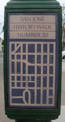
Erected by San Jose History Walk. (Marker Number 23.)
Topics and series. This historical marker is listed in this topic list: Notable Places. In addition, it is included in the Former U.S. Presidents: #25 William McKinley series list. A significant historical year for this entry is 1848.
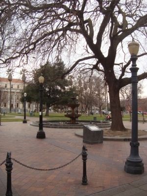
Location. 37° 20.331′ N, 121° 53.476′ W. Marker is in San Jose, California, in Santa Clara County. It is in Downtown San Jose. Marker is on North 2nd Street. This marker is located in St. James Park just east of North 2nd Street, between East James and East John Streets. Touch for map. Marker is in this post office area: San Jose CA 95113, United States of America. Touch for directions.
Other nearby markers. At least 8 other markers are within walking distance of this marker. Henry Morris Naglee (about 300 feet away, measured in a direct line); Sainte Claire Club (about 300 feet away); Santa Clara County Courthouse (about 300 feet away); First Church of Christ, Scientist (about 300 feet away); Trinity Episcopal Church (about 400 feet away); a different marker also named Trinity Episcopal Church (about 400 feet away); Main Post Office (about 400 feet away); First Unitarian Church (about 400 feet away). Touch for a list and map of all markers in San Jose.
Also see . . . Brooke Hart - Wikipedia. The history of the 1933 San Jose Lynching is told on this site. (Submitted on February 12, 2012, by Barry Swackhamer of Brentwood, California.)
Credits. This page was last revised on February 7, 2023. It was originally submitted on February 12, 2012, by Barry Swackhamer of Brentwood, California. This page has been viewed 901 times since then and 68 times this year. Photos: 1, 2, 3. submitted on February 12, 2012, by Barry Swackhamer of Brentwood, California. 4. submitted on April 25, 2010, by Syd Whittle of Mesa, Arizona. • Syd Whittle was the editor who published this page.


