Arlington Ridge in Arlington County, Virginia — The American South (Mid-Atlantic)
Fort Scott
Defenses of Washington
1861-1865
Fort Scott
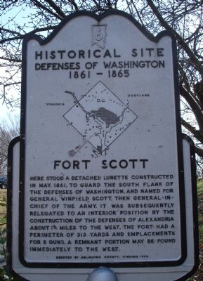
Here stood a detached lunette constructed in May, 1861, to guard the south flank of the defenses of Washington and named for General Winfield Scott, then General-in-Chief of the Army. It was subsequently relegated to an interior position by the construction of the defenses of Alexandria about 1¾ miles to the west. The Fort had a perimeter of 313 yards and emplacements for 8 guns. A remnant portion may be found immediately to the west.
Erected 1965 by Arlington County, Virginia. (Marker Number 6.)
Topics and series. This historical marker is listed in these topic lists: Forts and Castles • War, US Civil. In addition, it is included in the Defenses of Washington series list. A significant historical month for this entry is May 1861.
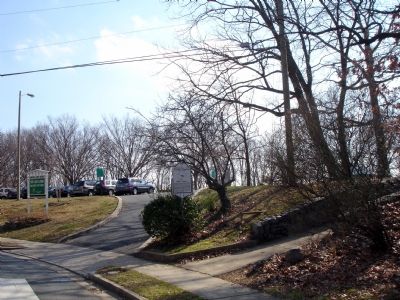
Location. 38° 50.85′ N, 77° 3.539′ W. Marker is in Arlington, Virginia, in Arlington County. It is in Arlington Ridge. Marker is on Fort Scott Drive, on the right when traveling east. Marker is located at the entrance to Fort Scott Park. Touch for map. Marker is at or near this postal address: 2800 Fort Scott Drive, Arlington VA 22202, United States of America. Touch for directions.
Other nearby markers. At least 8 other markers are within walking distance of this marker. Four Mile Run and Flooding / The Restoration Project / I Live Here...Can You Find Me? / Public Art (approx. 0.3 miles away); Transportation (approx. 0.4 miles away); Dr. Betty Louise Josephson King (approx. half a mile away); The Columns of This Portico (approx. half a mile away); History at Four Mile Run Park (approx. half a mile away); In Memory of an African-American Family (approx. 0.6 miles away); Arlington County September 11, 2001 Memorial (approx. 0.7 miles away); Mount Vernon Trail (approx. 0.7 miles away). Touch for a list and map of all markers in Arlington.
More about this marker. In the center of the marker is a map of the Washington Defenses, with a red (weathered) arrow pointing out the location of Fort Scott.
Additional commentary.
1. Fort Scott Particulars
From "Mr. Lincoln's Forts: A Guide to the Civil War Defenses of Washington," by Benjamin Franklin Cooling III and Walton H. Owen II:
The fort is described as a large lunette. It covered the Four Mile Run valley, and thus interlocked with Forts Reynolds and Barnard further to the west. Armament included
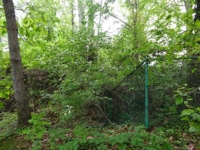
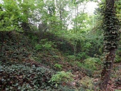
one 8-inch howitzer, five 24-pdr guns, one 20-pdr Parrott, one 6-pdr gun, and two 10-inch mortars. Two magazines, a guard house, a well house, and a bombproof barracks were enclosed within the fort. Troops stationed at the fort included the 1st Connecticut Heavy Artillery, 5th New York Heavy Artillery, 1st Massachusetts Heavy Artillery, 136th Ohio Infantry, and 142nd and 166th Ohio National Guard. Traces of the fort are visible inside Fort Scott Park.
— Submitted February 9, 2008, by Craig Swain of Leesburg, Virginia.
Credits. This page was last revised on February 1, 2023. It was originally submitted on February 9, 2008. This page has been viewed 1,769 times since then and 42 times this year. Photos: 1. submitted on February 9, 2008. 2. submitted on May 9, 2014, by Brian Cubbage of Alexandria, Virginia. 3. submitted on February 9, 2008. 4, 5. submitted on May 9, 2014, by Brian Cubbage of Alexandria, Virginia. • Craig Swain was the editor who published this page.


