West Point in Orange County, New York — The American Northeast (Mid-Atlantic)
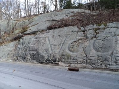
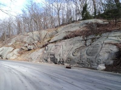
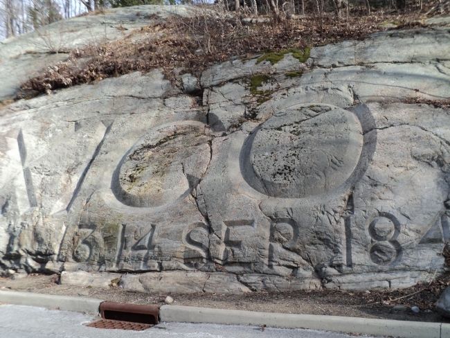
Battle of Mexico City
13 – 14 Sep 1847
Topics. This historical marker is listed in this topic list: War, Mexican-American. A significant historical date for this entry is September 14, 1847.
Location. 41° 23.779′ N, 73° 57.401′ W. Marker is in West Point, New York, in Orange County. Marker is on Howard Road, on the right when traveling north. Touch for map. Marker is in this post office area: West Point NY 10996, United States of America. Touch for directions.
Other nearby markers. At least 8 other markers are within walking distance of this marker. Fred E. McAniff & John R. Parker (within shouting distance of this marker); West Point in the American Revolution (about 300 feet away, measured in a direct line); Our National Heritage (about 300 feet away); Constitution Island (about 300 feet away); Sherburne’s Redoubt (about 300 feet away); In Memoriam (about 300 feet away); The Great Chain (about 300 feet away); Wars That Shaped the Nation (about 400 feet away). Touch for a list and map of all markers in West Point.
More about this marker. The text of the marker is cut into the rocks on the east side of the road.
Also see . . .
1. Mexican War Time Line. (Submitted on February 13, 2012, by Bill Coughlin of Woodland Park, New Jersey.)
2. Scott’s Entrance into Mexico City. Lithograph by Carl Nebel depicting Gen. Winfield Scott and his army entering Mexico City on September 14, 1847. (Submitted on February 13, 2012, by Bill Coughlin of Woodland Park, New Jersey.)
Credits. This page was last revised on June 16, 2016. It was originally submitted on February 13, 2012, by Bill Coughlin of Woodland Park, New Jersey. This page has been viewed 669 times since then and 19 times this year. Photos: 1, 2, 3. submitted on February 13, 2012, by Bill Coughlin of Woodland Park, New Jersey.


