Downtown San Jose in Santa Clara County, California — The American West (Pacific Coastal)
San José Diridon Station
Photographed by Barry Swackhamer, February 6, 2012
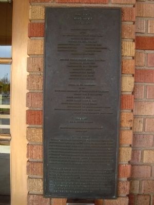
1. San José Diridon Station Marker
by the
By The
California Department of Transportation (Caltrans)
Johm H. Christle, Architect
Place in the National Register of Historic Places April 1, 1994
The narrow gauge South Pacific Coast Railroad began using the small wooden structure known as the “West San Jose Depot,” on land purchased from and transferred
this page online
Beginning in 1973, Supervisor Diridon, the son of an SP railroad brakeman, constantly led efforts to save the service and depot. He chaired the studies and helped found the [unclear]. He chaired the Save Peninsula Area Rail Commute Committee and Metropolitan Transportation Commission that led to the public ownership and upgrade. During his 23 years in elected office he chaired the Board of Supervisors and Transit District Board, Chaired the Guadalupe Corridor Light Rail and five other rail projects (including the
Photographed by Barry Swackhamer, February 6, 2012
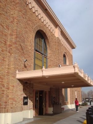
2. San José Diridon Station Marker
The marker is on the right side of the entrance.
Erected 1994 by Peninsula Corridor Joint Powers Board.
Topics. This historical marker is listed in this topic list: Railroads & Streetcars. A significant historical year for this entry is 1935.
Location. 37° 19.799′ N, 121° 54.142′ W. Marker is in San Jose, California, in Santa Clara County. It is in Downtown San Jose. It can be reached from Cahill Street south of West Santa Clara Street (California Route 82), on the right when traveling south. Touch for map. Marker is at or near this postal address: 65 Cahill Street, San Jose CA 95110, United States of America. Touch for directions.

Regionally, this marker is in California’s San Francisco Bay Area, in Silicon Valley, and on the Coast Ranges. It is also on the American Pacific Coast. Globally, it is in North America, on the Ring of Fire, on the Pacific Rim, in the Western Hemisphere, in the Western
Photographed by Barry Swackhamer, February 6, 2012
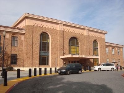
3. San José Diridon Station
Other nearby markers. At least 8 other markers are within walking distance of this marker: Remembering Agriculture (approx. 0.3 miles away); Henry's Hi-Life (approx. 0.4 miles away); Hotel De Anza (approx. half a mile away); The Palomar Ballroom (approx. half a mile away); College of Notre Dame (approx. half a mile away); International Business Machines : RAMAC (approx. half a mile away); Del Monte (approx. 0.6 miles away); Luis María Peralta Adobe (approx. 0.6 miles away). Touch for a list and map of all markers in San Jose.
Photographed by Barry Swackhamer, February 6, 2012
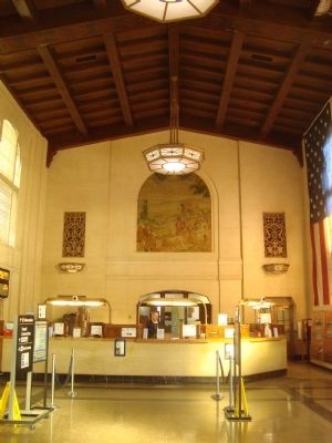
4. The Main Lobby of the San José Diridon Station
Credits. This page was last revised on February 7, 2023. It was originally submitted on February 14, 2012, by Barry Swackhamer of Brentwood, California. This page has been viewed 1,058 times since then and 38 times this year. Photos: 1, 2, 3, 4. submitted on February 14, 2012, by Barry Swackhamer of Brentwood, California. • Syd Whittle was the editor who published this page.
