Ingalls in Payne County, Oklahoma — The American South (West South Central)
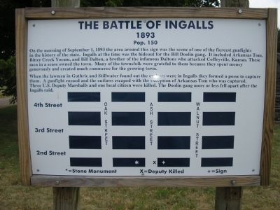
The Battle of Ingalls
1893
— Pop. 150 —
When lawmen from Guthrie and Stillwater found out the outlaws were in Ingalls they formed a posse to capture them. A gunfight ensued and the outlaws escaped with the exception of Arkansas Tom who was captured. Three U.S. Deputy Marshalls and one local citizen were killed. The Doolin gang more or less fell apart after the Ingalls raid.
Topics. This historical marker is listed in this topic list: Notable Events. A significant historical date for this entry is September 1, 1758.
Location. 36° 6.095′ N, 96° 52.736′ W. Marker is in Ingalls, Oklahoma, in Payne County. Marker is on East 19th Avenue (County Road E0630) 0.1 miles east of South Walnut Street, on the right when traveling east. Touch for map. Marker is in this post office area: Stillwater OK 74074, United States of America. Touch for directions.
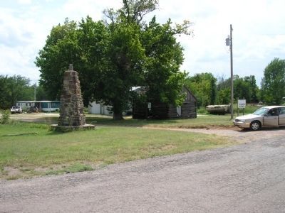
Other nearby markers. At least 8 other markers are within 11 miles of this marker, measured as the crow flies. U.S. Marshals Monument (a few steps from this marker); Outlaw Battle (approx. 1.2 miles away); Battle of Round Mountains (approx. 6.1 miles away); Nell Caroline Woodward Hancock (approx. 10.1 miles away); L.F. Jones (approx. 10.1 miles away); Mable Dale Potts (approx. 10.1 miles away); Rice/Kerby Cabin (approx. 10.6 miles away); Harold V. "Tex" Brown (approx. 10.8 miles away). Touch for a list and map of all markers in Ingalls.
Also see . . . History - Deputies versus the Wild Bunch. U.S. Marshals Service (Submitted on February 16, 2012, by Bernard Fisher of Richmond, Virginia.)
Credits. This page was last revised on July 21, 2016. It was originally submitted on February 15, 2012, by Michael Manning of Woodlawn, Tennessee. This page has been viewed 949 times since then and 38 times this year. Photos: 1, 2. submitted on February 15, 2012, by Michael Manning of Woodlawn, Tennessee. • Bernard Fisher was the editor who published this page.

