Forestville in Shenandoah County, Virginia — The American South (Mid-Atlantic)
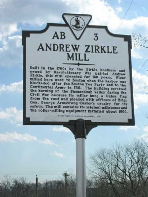
Andrew Zirkle Mill
Erected 2007 by Department of Historic Resources. (Marker Number AB-3.)
Topics and series. This historical marker is listed in these topic lists: Industry & Commerce • War, US Civil • War, US Revolutionary. In addition, it is included in the Virginia Department of Historic Resources (DHR) series list. A significant historical year for this entry is 1781.
Location. 38° 42.856′ N, 78° 43.314′ W. Marker is in Forestville, Virginia, in Shenandoah County. Marker is on Quicksburg Road (County Route 767) 0.2 miles east of Senedo Road/Middle Road and Quicksburg Road, on the left when traveling east. Mill is on Holman's Creek, a tributary of the North Fork of the Shenandoah River. It is about 8 miles from New Market, VA. Touch for map. Marker is in this post office area: Quicksburg VA 22847, United States of America. Touch for directions.
Other nearby markers. At least 8 other markers are within 4 miles of this marker, measured as the crow flies. Meem's Bottom Covered Bridge (approx. 3.6 miles away); Action at Mill Creek (approx. 3.9 miles away); Rude’s Hill (approx. 4 miles away); Rude’s Hill Action (approx. 4 miles away); a different marker also named Rude's Hill (approx. 4 miles away); a different marker also named Rude’s Hill (approx. 4 miles away); Cavalry Engagement (approx. 4 miles away); a different marker also named Meem’s Bottom Covered Bridge (approx. 4.1 miles away).
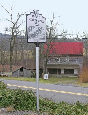
More about this marker. Marker is across the road from the mill and is in front of the Forestville-Quicksburg Ruritan Community Center.
Also see . . .
1. Zirkle Mill. Website homepage (Submitted on February 9, 2008, by Linda Walcroft of Woodstock, Virginia.)
2. The Zirkle Mill. The Cultural Landscape Foundation website entry (Submitted on February 10, 2008, by Kevin W. of Stafford, Virginia.)
Credits. This page was last revised on May 24, 2022. It was originally submitted on February 9, 2008, by Linda Walcroft of Woodstock, Virginia. This page has been viewed 2,156 times since then and 33 times this year. Photos: 1, 2. submitted on February 9, 2008, by Linda Walcroft of Woodstock, Virginia. • Craig Swain was the editor who published this page.

