Forest Lake in Washington County, Minnesota — The American Midwest (Upper Plains)
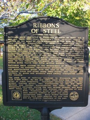
Ribbons of Steel
Photographed by Keith L, September 28, 2007
1. Ribbons of Steel Marker
Railroads were critical to the development of Minnesota; they connected its citizens, agricultural products, natural resources, and manufactured goods with the rest of the country. They promoted towns and cities along their routes, and opened new markets as goods and products were swiftly transported
this page online
The peak year of railroad trackage in Minnesota was 1929 with 9,500 miles. By the mid 1990s there were less than 5,000 miles of track remaining. Passenger service, except for the modest Amtrak effort, was discontinued by the mid 1970s. Decline and further consolidation has been the fate of Minnesota's railroads during the last several decades, and many small towns and rural areas are without rail service of any kind. Numerous miles of right-of-way, once bearing ribbons of steel, now serve recreational uses; many former railroad depots have been adapted for new uses and are tangible reminders of the past.
Erected 1997 by the Minnesota Historical Society.
Topics and series. This historical marker is listed in this topic list: Railroads & Streetcars. In addition, it is included in the Minnesota Historical Society series list. A significant historical year for this entry is 1853.
Location. 45° 16.216′ N, 93° 0.552′ W. Marker is in Forest Lake, Minnesota, in Washington County. It can be reached from Interstate 35 at milepost 131, 0.7 miles south of West Broadway Avenue (County Highway 2), on the right when traveling
Photographed by Keith L, September 28, 2007
2. Ribbons of Steel Marker

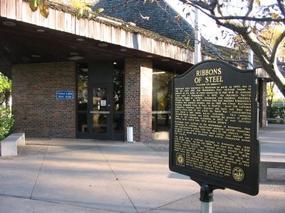
Regionally, this marker is in the Twin Cities Metropolitan Area. It is also in the American Midwest, in the Corn Belt, and in the Great River Road Region. Globally, it is in North America, the Western Hemisphere, the Western World, and the Anglosphere. Historically, it finds itself in what was once Rupert’s Land, the territory of the Mississippian Culture, and the Northwest Territory.
Other nearby markers. At least 8 other markers are within 10 miles of this marker, measured as the crow flies: Vilhelm Moberg (approx. 9.1 miles away); Vilhelm Moberg Park (approx. 9.1 miles away); Navy SEAL Nicholas P. Spehar Memorial Highway (approx. 9.2 miles away); Extortion 17 Memorial (approx. 9.2 miles away); Chisago City Veterans Memorial (approx. 9.2 miles away); In Memory of the First Swedish Settlers in Minnesota (approx. 9.6 miles away); Swedes in Minnesota (approx. 9.9 miles away); The Swedish Evangelical Lutheran Church of Ham Lake (approx. 10 miles

Photographed by Keith L, July 23, 2011
3. Blue Star Memorial Highway Marker
Photographed by Keith L, September 26, 2007
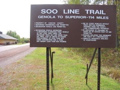
4. Soo Line Trail
A former railroad at Moose Lake (86 miles north of the marker) is now a recreational trail.
Photographed by Keith L, September 26, 2007
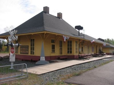
5. Moose Lake Area Historical Museum
The former Moose Lake Depot, a national historic site, was built in 1910.
Credits. This page was last revised on June 16, 2016. It was originally submitted on February 10, 2008, by Keith L of Wisconsin Rapids, Wisconsin. This page has been viewed 1,711 times since then and 35 times this year. Photos: 1, 2. submitted on February 10, 2008, by Keith L of Wisconsin Rapids, Wisconsin. 3. submitted on August 10, 2011, by Keith L of Wisconsin Rapids, Wisconsin. 4, 5. submitted on February 10, 2008, by Keith L of Wisconsin Rapids, Wisconsin. • J. J. Prats was the editor who published this page.
