Readingsburg in Hunterdon County, New Jersey — The American Northeast (Mid-Atlantic)
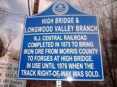
High Bridge and Longwood Valley Branch

Photographed By William Honachefsky Jr, February 12, 2008
1. High Bridge and Longwood Valley Branch Marker
Erected 2007 by Hunterdon County Cultural and Heritage Commission.
Topics and series. This historical marker is listed in this topic list: Railroads & Streetcars. In addition, it is included in the New Jersey, Hunterdon County Cultural and Heritage Commission series list. A significant historical year for this entry is 1875.
Location. 40° 40.854′ N, 74° 52.767′ W. Marker is in Readingsburg, New Jersey, in Hunterdon County. Marker is on Cokesbury Road (County Route 639) near Columbia Trail (recreational), on the right when traveling north. Touch for map. Marker is in this post office area: Annandale NJ 08801, United States of America. Touch for directions.
Other nearby markers. At least 8 other markers are within walking distance of this marker. Hamlet of Readingsburg (approx. 0.2 miles away); Taylor Steelworkers Historic Greenway (approx. 0.6 miles away); Solitude Falls (approx. 0.6 miles away); Welcome to the Twp. of Lebanon (approx. 0.6 miles away); High Bridge Company 1268 / Civilian Conservation Corps (approx. ¾ mile away); Solitude (approx. ¾ mile away); Solitude House (approx. ¾ mile away); Lake Solitude and Taylor Falls (approx. 0.8 miles away).
Click on the ad for more information.
Please report objectionable advertising to the Editor.
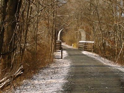
sectionhead>More about this marker. The Columbia Trail passes over Cokesbury Road near this marker. The Columbia Trail is the former High Bridge Branch rail line that is now a recreational trail. Today the trail spans seven miles from High Bridge to the Morris County line. It provides passive recreation to the surrounding communities through hiking, biking, and cross country skiing.
Please report objectionable advertising to the Editor.
Credits. This page was last revised on June 16, 2016. It was originally submitted on February 10, 2008, by William Honachefsky Jr of High Bridge/Clinton Twp, New Jersey. This page has been viewed 1,477 times since then and 18 times this year. Photos: 1, 2. submitted on February 10, 2008, by William Honachefsky Jr of High Bridge/Clinton Twp, New Jersey. • Kevin W. was the editor who published this page.
