Sea Cliff in San Francisco City and County, California — The American West (Pacific Coastal)
China Beach
灘海國中
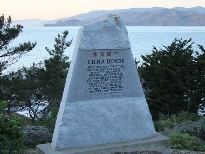
Photographed by Jordan Yee AKA "Ranger Yee", circa December 2009
1. China Beach Marker
Erected 1981 by Henry & Diana Chung Family.
Topics and series. This historical marker is listed in these topic lists: Industry & Commerce • Notable Places • Waterways & Vessels. In addition, it is included in the Chinese Heritage Sites of the American West series list.
Location. 37° 47.238′ N, 122° 29.45′ W. Marker is in San Francisco, California, in San Francisco City and County. It is in Sea Cliff. It is on Seacliff Avenue near End of Seacliff, on the right when traveling west. The Golden Gate Parks Conservancy describes the location of this site thus, "The tiny cove of China Beach lies between Baker Beach and Lands End.". Touch for map. Marker is in this post office area: San Francisco CA 94121, United States of America. Touch for directions.

Regionally, this marker is on the Coast Ranges. It
this page online
Other nearby markers. At least 8 other markers are within walking distance of this marker: Soldiers who Perished in WWII (approx. half a mile away); Western Terminus of the Lincoln Highway (approx. half a mile away); Frances E. Willard (approx. half a mile away); "The Holocaust" (approx. half a mile away); Jeanne d'Arc (approx. half a mile away); The Arrival of the First Japanese Naval Ship (approx. 0.6 miles away); Historic Shipwrecks - Lost at the Golden Gate (approx. ¾ mile away); Public Health Service District (approx. 0.9 miles away). Touch for a list and map of all markers in San Francisco.
More about this marker. The Golden Gate Parks Conservancy says this on its website about China Beach, "Legend has it that local residents named China Beach for the Chinese fishermen who, long ago, anchored their junks in the cove and camped on the beach."
The
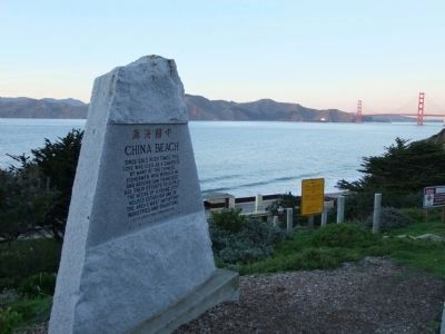
Photographed by Jordan Yee AKA "Ranger Yee", December 2009
2. China Beach Marker
China Beach lies very close to the opening of the Golden Gate. To the east is the Golden Gate Bridge and the San Francisco Bay waters.
Additional commentary.
1. The Rest of the Story
Chinese fishing from China Beach came to an end in the 1890s. “In 1880 California passed “An Act Relating to Fishing in the Waters of this State”: “All aliens incapable of becoming electors of this state are hereby prohibited from fishing, or taking any fish, lobster, shrimp, of shell fish of any kind, for the purposes of selling, or giving to another person to sell...” Conveniently, only Chinese were aliens not eligible to vote.” While this bill was declared unconstitutional, the legislature continued to pass similar measures. “White thuggery” eventually forced the Chinese out of fishing.
The beach was ‘renamed’ Phelan Beach, in honor of three-term San Francisco mayor and US Senator (1915-21), James Phelan. As San Francisco mayor, Phelan allowed a blockade and quarantine of Chinatown, and as US. Senator, Phelan supported laws prohibiting Japanese from owning land in California.
Reference:
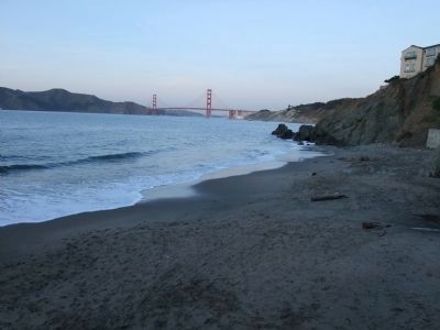
Photographed by Jordan Yee AKA "Ranger Yee", December 2009
3. View from China Beach at the waterline looking East
According to the Golden Gate National Recreation Area (NPS) "In the late 19th century Chinese fishermen anchored their boats in this wind-protected cove and camped on the shore."
— Submitted November 30, 2011, by Barry Swackhamer of Brentwood, California.
Credits. This page was last revised on February 7, 2023. It was originally submitted on January 5, 2010, by Jordan Yee AKA "Ranger Yee" of Fremont, California. This page has been viewed 2,029 times since then and 63 times this year. Last updated on February 24, 2012. Photos: 1, 2, 3. submitted on January 5, 2010, by Jordan Yee AKA "Ranger Yee" of Fremont, California. • Syd Whittle was the editor who published this page.
