Tappan in Rockland County, New York — The American Northeast (Mid-Atlantic)
Hickory Hill Cooperative
Photographed by Bill Coughlin, February 24, 2012
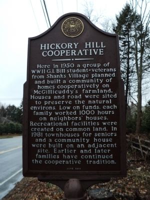
1. Hickory Hill Cooperative Marker
Here in 1950 a group of WWII G.I. Bill student-veterans from Shanks Village planned and built a community of homes cooperatively on McGillicuddy’s farmland. Houses and road were sited to preserve the natural environs. Low on funds, each family worked 1000 hours on neighbors’ houses. Recreational facilities were created on common land. In 1981 townhouses for seniors and a community house were built on an adjacent site. Earlier and later families have continued the cooperative tradition.
Erected 2000 by Historical Society of Rockland County.
Topics and series. This historical marker is listed in this topic list: Settlements & Settlers. In addition, it is included in the New York, Historical Society of Rockland County series list. A significant historical year for this entry is 1950.
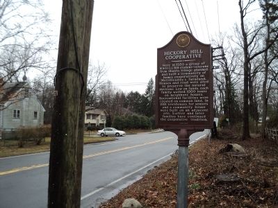
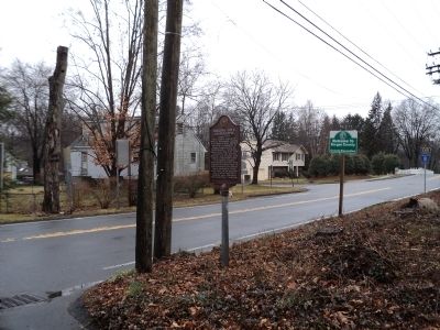
Location. 41° 1.359′ N, 73° 57.503′ W. Marker is in Tappan, New York, in Rockland County. It is at the intersection of Old Tappan Road (County Route 8) and Hickory Hill Road, on the right when traveling west on Old Tappan Road. Marker is located just north of the New Jersey border. Touch for map. Marker is in this post office area: Tappan
this page online

Regionally, this marker is in the Hudson Valley and in the New York City Metropolitan Area. It is also in the American Northeast, in the Mid-Atlantic, and on the Eastern Seaboard. Globally, it is in the North Atlantic Region, North America, the Western Hemisphere, the Western World, and the Anglosphere. Historically, it finds itself in what was once New Netherland and also one of the original Thirteen Colonies.
Other nearby markers. At least 8 other markers are within walking distance of this marker: Major John André (approx. 0.2 miles away); André Monument (approx. 0.2 miles away); Tappan Historic District (approx. 0.4 miles away); a different marker also named Tappan Historic District (approx. half a mile away); Teunis Haring House (approx. half a mile away in New Jersey); The Manse (approx. half a mile away); The First Courthouse (approx. half a mile away); Tappan Vietnam Veterans Memorial (approx. half a mile away). Touch for a list and map of all markers in Tappan.
Another marker is no longer nearby. Andre Monument (was approx. 0.2 miles away but has
Photographed by Bill Coughlin, February 24, 2012
2. Hickory Hill Cooperative Marker
Photographed by Bill Coughlin, February 24, 2012
3. Marker on Old Tappan Road
Credits. This page was last revised on June 16, 2016. It was originally submitted on February 24, 2012, by Bill Coughlin of Woodland Park, New Jersey. This page has been viewed 1,345 times since then and 78 times this year. Photos: 1, 2, 3. submitted on February 24, 2012, by Bill Coughlin of Woodland Park, New Jersey.
