Goldfield in Esmeralda County, Nevada — The American Mountains (Southwest)
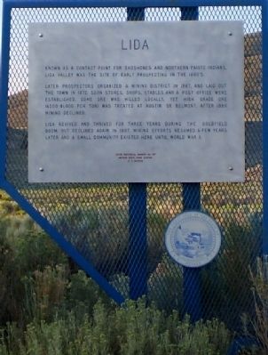
Lida
Later prospectors organized a mining district in 1867 and laid out the town in 1872. Soon stores, shops, stables and a Post Office were established. Some ore was milled locally. Yet high grade ore (500 dollars - 1,000 dollars per ton) was treated at Austin or Belmont. After 1880 mining declined.
Lida revived and thrived for three years during the Goldfield boom, but declined again in 1907. Mining efforts resumed a few years later and a small community existed here until World War I.
Erected by Nevada State Park System, E. F. Denton. (Marker Number 157.)
Topics. This historical marker is listed in these topic lists: Industry & Commerce • Settlements & Settlers. A significant historical year for this entry is 1867.
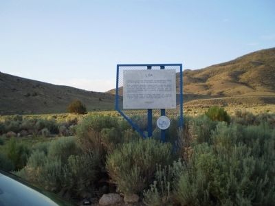
Location. 37° 27.317′ N, 117° 29.967′ W. Marker is in Goldfield, Nevada, in Esmeralda County. Marker is on Nevada Route 266, 19 miles west of Nevada Highway 95, on the left when traveling west. Marker is 11 miles East of the Palmetto Marker, and 20 miles West of Highway 95 in Nevada on State Route 266. The area is mostly desert and is sparsely populated. Touch for map. Marker is in this post office area: Goldfield NV 89013, United States of America. Touch for directions.
Other nearby markers. At least 3 other markers are within 11 miles of this marker, measured as the crow flies. Pigeon Spring (approx. 9˝ miles away); Gold Point (approx. 10.2 miles away); Palmetto (approx. 10.7 miles away).
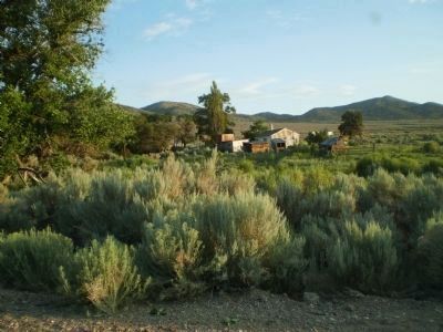
Regarding Lida. The Lida Post Office was originally designated as Inyo County, California as no one was really sure where the state boundary was at that time. The town "magically moved" to Nevada after the borders were verified in 1873.
Also see . . .
1. Lida Ghost Town. (Submitted on February 25, 2012, by Lester J Letson of Fresno, California.)
2. New Amended Text for Marker. The Nevada State Historic Preservation Office (SHPO) recently updated the text of the roughly 260 state historical markers in Nevada. The Nevada SHPO placed the amended text of each individual marker on its website and will change the actual markers in the field as funding allows. Minor changes have been made to the marker for grammar and readability. The link will take you to the Nevada SHPO page for the marker with the amended text. (Submitted on November 12, 2013, by Duane Hall of Abilene, Texas.)
Credits. This page was last revised on June 16, 2016. It was originally submitted on February 25, 2012, by Lester J Letson of Fresno, California. This page has been viewed 828 times since then and 22 times this year. Photos: 1, 2, 3. submitted on February 25, 2012, by Lester J Letson of Fresno, California. • Syd Whittle was the editor who published this page.


