Near Spotsylvania Courthouse in Spotsylvania County, Virginia — The American South (Mid-Atlantic)
The Brown House
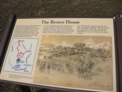
As dawn approached, officers quietly woke the men from their sleep and formed them into lines of battle. "There was something terribly weird in this massing of troops at this time of day, in the hooting of owls as the dark figures of men moved through the pines, in the sobbing of the wind through the wet trees," thought one soldier. Drenched to the skin, their teeth chattering with cold, the men stepped out. The most horrible day of fighting in American history was about to begin.
Topics. This historical marker is listed in this topic list: War, US Civil. A significant historical month for this entry is May 1980.
Location. 38° 13.858′ N, 77° 36.304′ W. Marker is near Spotsylvania Courthouse, Virginia, in Spotsylvania County. Marker is at the intersection of Willow Ridge Way and Burnleigh Street, on the left when traveling south on Willow Ridge Way. Marker is opposite 9930 Willow Ridge Way, in the "Stuart's Crossing" development. Driving East on Gordon Rd (Rt 627), turn right into Browns Farm Rd, then right into Willow Ridge Ln, finally right into Willow Ridge Way. Touch for map. Marker is at or near this postal address: 9930 Willow Ridge Way, Spotsylvania VA 22553, United States of America. Touch for directions.
Other nearby markers. At least 8 other markers are within walking distance of this marker. Union Earthworks (here, next to this marker); Vista Clearing at Spotsylvania (approx. half a mile away); Spotsylvania Campaign (approx. half a mile away); a different marker also named Spotsylvania Campaign (approx. half a mile away); Upton’s Trail (approx. half a mile away); 126th Ohio Volunteer Infantry (approx. half a mile away); a different marker also named Spotsylvania Campaign (approx. 0.6 miles away); Attack on the Muleshoe (approx. 0.6 miles away). Touch for a list and map of all markers in Spotsylvania Courthouse.
More about this marker. The sign has a diagram showing Confederate and Union positions and movements around the Muleshoe Salient, and a drawing with the caption: "On May 12, Union troops captured 20 Confederate cannon. Artist Edwin Forbes later sketched the guns after they were brought to the Brown house."
Credits. This page was last revised on July 9, 2021. It was originally submitted on February 25, 2012. This page has been viewed 457 times since then and 6 times this year. Photos: 1. submitted on February 25, 2012. • Craig Swain was the editor who published this page.
