Tehachapi in Kern County, California — The American West (Pacific Coastal)
Monolith
California
Photographed by Denise Boose, September 10, 2023
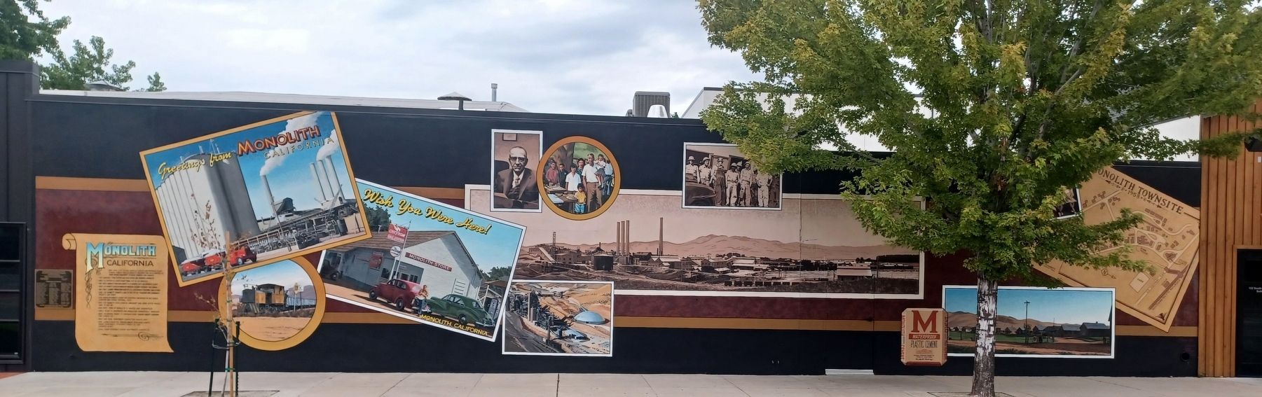
1. Monolith Marker
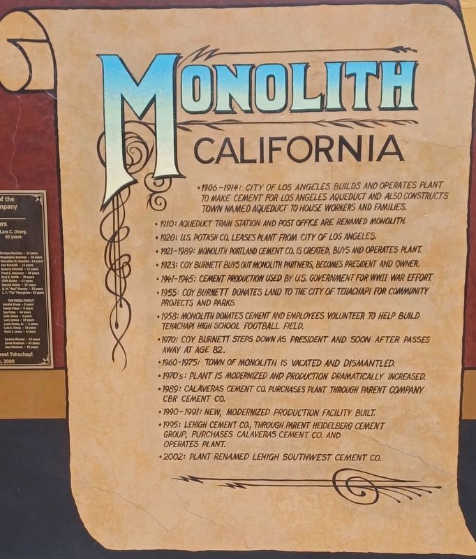
1906-1914: City of Los Angeles builds and operates plant to make cement for Los Angeles Aqueduct and also constructs town named Aqueduct to house workers and families.
1910: Aqueduct train station and post office are renamed Monolith.
1920: U.S. Potash Co. leases plant from City of Los Angeles.
1921-1989: Monolith Portland Cement Co. is created, buys and operates plant.
1923: Coy Burnett buys out Monolith partners, becomes President and owner.
1941-1945: Cement production used by U.S. Government for WWII War effort.
1955: Coy Burnett donates land to the City of Tehachapi for community projects and parks.
1958: Monolith donates cement and employees volunteer to help build Tehachapi High School Football Field.
1970: Coy Burnett steps down as President and soon after passes away at age 82.
1960-1975: Town of Monolith is vacated and dismantled.
1970’s: Plant is modernized and production dramatically increased.
1989: Calaveras Cement Co. purchases plant through parent company CBR Cement Co.
1990-1991: New, modernized production facility built.
1995: Lehigh Cement Co., through parent Heidelberg Cement Group, purchases Calaveras Cement Co. and operates plant.
2002: Plant renamed Lehigh Southwest Cement Co.
Erected 2008 by Main
this page online
Topics. This historical marker is listed in these topic lists: Education • Industry & Commerce • Railroads & Streetcars • Settlements & Settlers • Sports • Waterways & Vessels. A significant historical year for this entry is 1910.
Location. 35° 7.864′ N, 118° 26.84′ W. Marker is in Tehachapi, California, in Kern County. It is on East F Street, on the left when traveling east. This is located on the south side of St. Vincent De Paul Thrift Store. Touch for map. Marker is at or near this postal address: 122 South Green St, Tehachapi CA 93561, United States of America. Touch for directions.

Regionally, this marker is in the San Joaquin Valley, specifically in the Central Valley, and in the Sierra Nevada. It is also on the American Pacific Coast. Globally, it is in North America, on the Ring of Fire, on the Pacific Rim, in the Western Hemisphere, in the Western World, and in the Anglosphere. Historically, it finds itself in what was once New Spain and also Mexico’s Alta California.
Other nearby markers. At least 8 other markers are within walking distance of this marker: Tehachapi Airport and Gliderport (within shouting distance of this marker); The Women's Prison in Tehachapi - 1932 (within shouting distance of this marker); What a Shock! The 1952 Earthquake
Photographed by Denise Boose, February 18, 2012
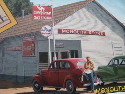
2. The Monolith Store
It was owned by Ed Tompkins. It was a cafe, post office, and sold gasoline and sat right across the street from the plant.
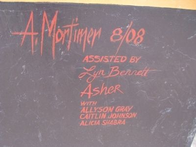
More about this marker. Painted by artist Art Mortimer. Assisted by Lyn Bennett Asher with Allyson Gray, Caitlin Johnson, Alicia Shabra.
Photographed by Denise Boose, February 18, 2012
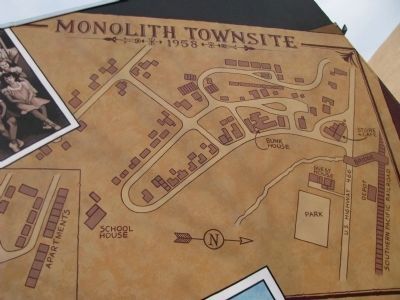
3. Monolith Townsite-1958

Photographed by Denise Boose, February 18, 2012
4. Monolith Marker
Photographed by Denise Boose, February 18, 2012
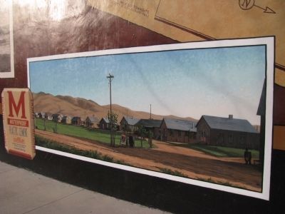
5. Monolith Marker
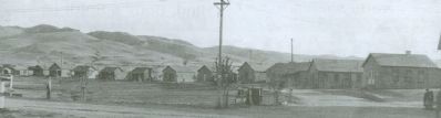
Photographed by Denise Boose
6. Monolith in the 1920's
From The Tehachapi News.
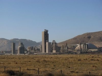
Photographed by Denise Boose, October 5, 2036
7. Lehigh Cement Company-Tehachapi Plant
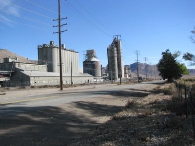
Photographed by Denise Boose, October 15, 2036
8. Lehigh Cement Company-Tehachapi Plant
Taken from across the street on Techachapi Blvd.
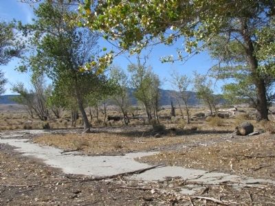
Photographed by Denise Boose, October 15, 2036
9. Possibly the Monolith Store foundation
Photographed by Denise Boose, October 15, 2036
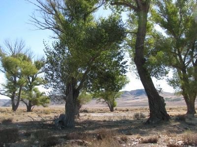
10. Monolith's Trees
If you look at the photo from the 1920's, you can see when these trees were planted and can almost imagine the homes that had surrounded them.
Photographed by Denise Boose, February 18, 2012
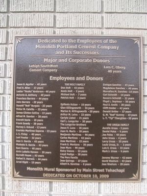
11. Dedication Plaque
Dedicated to the Employees of the Monolith Portland Cement Company and Its Successors. Dedicated on October 10, 2009
Photographed by Denise Boose, February 18, 2012
12. Art Mortimer
Assisted by Lyn Bennett Asher with Allyson Gray, Caitlin Johnson, Alicia Shabra.
Photographed by Denise Boose, May 31, 2012
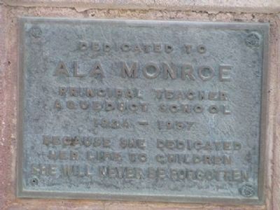
13. Ala Monroe Dedication Plaque Located at the Old Monoroe High School
Ala Monroe
Principal-Teacher
Aqueduct School
1934 - 1957
Because she dedicated
Her life to children
She will never be forgotten.
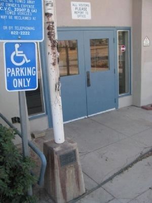
Photographed by Denise Boose, May 31, 2012
14. Ala Monroe Dedication Plaque Located on the Flagpole Base.
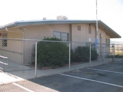
Photographed by Denise Boose, May 31, 2012
15. Monroe High School
This was built during the 60's for the community of Monolith. It became a continuation school called Monroe High School and has since has been sold to the Kern County Fire Department for use as a staging station.
Photographed by Denise Boose, May 31, 2012
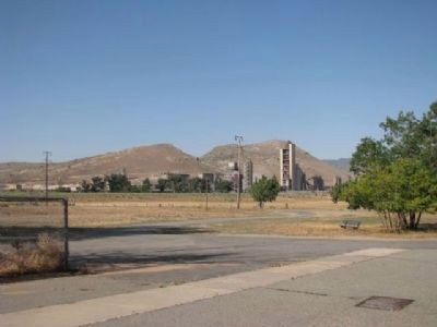
16. Ala Monroe Marker
A view from Monroe High School of the cement plant and the old town site of Monolith.
Photographed by Denise Boose, September 10, 2023
17. Monolith Marker

Photographed by Denise Boose, March 15, 2014
18. Monolith School 1946
Courtesy of Kelcy's Restaurant & Ed Tompkins
Credits. This page was last revised on September 25, 2023. It was originally submitted on February 26, 2012, by Denise Boose of Tehachapi, California. This page has been viewed 2,668 times since then and 149 times this year. Photos: 1. submitted on September 10, 2023, by Denise Boose of Tehachapi, California. 2, 3, 4, 5, 6, 7, 8, 9, 10, 11, 12. submitted on February 26, 2012, by Denise Boose of Tehachapi, California. 13, 14, 15, 16. submitted on June 9, 2012, by Denise Boose of Tehachapi, California. 17. submitted on September 10, 2023, by Denise Boose of Tehachapi, California. 18. submitted on March 16, 2014, by Denise Boose of Tehachapi, California. • Syd Whittle was the editor who published this page.
