Cockeysville in Baltimore County, Maryland — The American Northeast (Mid-Atlantic)
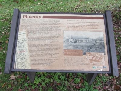
Phoenix
The first industry at what eventually became Phoenix, was a gristmill started in 1793 by Elijah Merryman and known as "Gunpowder Mills". A saw mill and a woolen mill soon followed. In 1848, Baltimore mill owner Thomas H. Fulton founded Phoenix Cotton Mill. When he died shortly after 1851, the property was sold at public auction. The auction notice listed a "factory house" 100 by 36 feet with an iron water wheel, a stone dam with 9 feet of waterfall, plus a town with 21 brick and log houses, a store, and a 2-story house. The property sold for $28,550. For the next few years the mill had a variety of owners. In 1875, the property was obtained by the Garrett family, noted Baltimore investment bankers. With improvements including a 54 inch turbine wheel and a 175 HP reserve steam engine, the mill was placed back in production in 1881. At this time the mill town had grown to 68 dwellings, the worker force numbered over 200, and 6,000 spindles were being used to manufacture twill and sheeting goods.
In 1903, the U.S. Cotton Duck Corporation, which now owned the mill, ceased its operations at Phoenix to take advantage of lower manufacturing costs in Alabama. By 1911, the town was nearly deserted as the area was expected to be flooded by the expansion of the Loch Raven Reservoir project. The final design of the Loch Raven high dam brought back the waters of the reservoir to the very walls of the mill. In 1922, Baltimore City obtained Phoenix, along with Warren Mill further downstream, for $1,000,000. Warren Mill was drowned by the reservoir expansion and Phoenix, with its 4-story mill of Beaver Dam marble, was demolished.
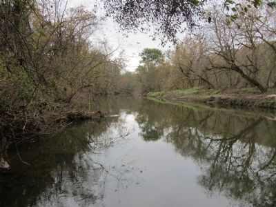
Today only a roadside pond, the remains of the millraces, some fragments of a rail spur, and a few stone foundations mark the location of the once prosperous cotton duck industry that created the original village of Phoenix.
The Baltimore County Union, Dec. 13, 1873
"Phoenix is a cotton manufacturing town of considerable importance on the Northern Central Railway .... containing a population of 350. Its commercial interests consist of a very extensive cotton mill recently erected to take the lace of an old one of less capacity. Also included in the town are 30 of the best and most convenient dwelling houses for the use of the operatives".
Topics. This historical marker is listed in these topic lists: Industry & Commerce • Railroads & Streetcars. A significant historical date for this entry is December 13, 1873.
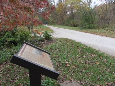
Location. 39° 31.156′ N, 76° 37.17′ W. Marker is in Cockeysville, Maryland, in Baltimore County. Marker can be reached from Phoenix Road, one mile north of Paper Mill Road (Maryland Route 145), on the left when traveling north. Marker is up on the North Central Railroad Trail, accessed from the parking lot. Touch for map. Marker is in this post office area: Cockeysville MD 21030, United States of America. Touch for directions.
Other nearby markers. At least 8 other markers are within 4 miles of this marker, measured as the crow flies. Lime Kiln (approx. one mile away); North Central Railroad Trail (approx. 1.4 miles away); Gilmor's Raid (approx. 1.4 miles away); Sparks (approx. 1.7 miles away); Clynmalira (approx. 1.9 miles away); Hayfields (approx. 3.3 miles away); Gorsuch Tavern (approx. 3˝ miles away); My Lady's Manor (approx. 3.7 miles away). Touch for a list and map of all markers in Cockeysville.
Credits. This page was last revised on February 3, 2024. It was originally submitted on March 4, 2012, by F. Robby of Baltimore, Maryland. This page has been viewed 1,633 times since then and 81 times this year. Photos: 1, 2, 3. submitted on March 4, 2012, by F. Robby of Baltimore, Maryland.


