Near Duncan in Platte County, Nebraska — The American Midwest (Upper Plains)
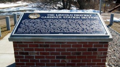
The Lincoln Highway - Gardiner Station Section
Inscription.
The Lincoln Highway Association was founded in 1913 to promote a coast-to-coast, toll- free automobile route. The Lincoln Highway, which followed existing roadways through thirteen states, was dedicated on October 31, 1913. The route was marked by the letter "L" within red, white, and blue bands, painted on telephone poles or signs.
In Nebraska the Lincoln Highway continued the evolution of the Platte River Valley as a significant travel corridor in American history. Used by fur traders, the U.S. Army, overland emigrants, and the transcontinental railroad during the nineteenth century, the valley remains an important modern railroad and highway route.
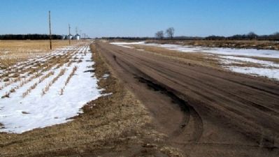
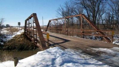
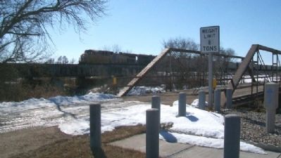
This 1.2-mile Gardiner Station section of the original Lincoln Highway and the Pratt pony-truss bridge spanning Prairie Creek were in use from 1913 to 1928, when this highway section was rerouted south of the Union Pacific tracks. By then the Lincoln Highway had received federal designation as U.S. Highway 30. The original highway section and bridge are listed in the National Register of Historic Places.
Erected 2009 by Nebraska Chapter, Lincoln Highway Association and Nebraska State Historical Society. (Marker Number 462.)
Topics and series. This historical marker is listed in these topic lists: Bridges & Viaducts • Railroads & Streetcars • Roads & Vehicles. In addition, it is included in the Lincoln Highway, and the Nebraska State Historical Society series lists. A significant historical date for this entry is October 31, 1913.
Location. 41° 21.209′ N, 97° 34.647′ W. Marker is near Duncan, Nebraska, in Platte County. Marker is on U.S. Hwy 30 Frontage Road (original Lincoln Hwy), 0.1 miles east of the intersection of 355th Avenue and 115th Street, on the left when traveling east. Marker is along Prairie Creek, about five miles southwest of Duncan. Touch for map. Marker is in this post office area: Duncan NE 68634, United States of America. Touch for directions.
Other nearby markers. At least 8 other markers are within 12 miles of this marker, measured as the crow flies. Gardiner School (here, next to this marker); Duncan (approx. 5.1 miles away); Lincoln Highway (approx. 5.1 miles away); 1776 Bicentennial 1976 (approx. 5.1 miles away); U. S. Indian Industrial School Building (approx. 10.1 miles away); Genoa: 1857-1859 (approx. 10.3 miles away); Pawnee (approx. 10.3 miles away); Osceola And The Early Pioneers (approx. 11.8 miles away). Touch for a list and map of all markers in Duncan.
Also see . . .
1. Lincoln Highway Association
. (Submitted on March 4, 2012, by William Fischer, Jr. of Scranton, Pennsylvania.)
2. Lincoln Highway. (Submitted on March 4, 2012, by William Fischer, Jr. of Scranton, Pennsylvania.)
Credits. This page was last revised on November 30, 2020. It was originally submitted on March 4, 2012, by William Fischer, Jr. of Scranton, Pennsylvania. This page has been viewed 738 times since then and 20 times this year. Photos: 1, 2, 3, 4. submitted on March 4, 2012, by William Fischer, Jr. of Scranton, Pennsylvania.


