Near La Grange in Fayette County, Texas — The American South (West South Central)
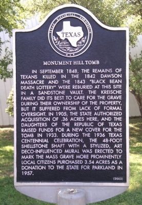
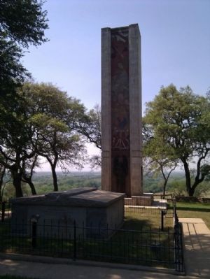
Monument Hill Tomb
Erected 2002 by Texas Historical Commission. (Marker Number 12756.)
Topics and series. This historical marker is listed in these topic lists: Architecture • Cemeteries & Burial Sites • War, Texas Independence. In addition, it is included in the Art Deco series list. A significant historical month for this entry is September 1848.
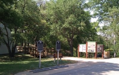
Location. 29° 53.278′ N, 96° 52.567′ W. Marker is near La Grange, Texas, in Fayette County. Marker can be reached from Park Drive (State Highway 92 Spur) 0.3 miles west of U.S. 77, on the right when traveling west. Located in the parking lot of Monument Hill State Park as you approach the Ranger Station. Touch for map. Marker is at or near this postal address: 414 State Loop 92, La Grange TX 78945, United States of America. Touch for directions.
Other nearby markers. At least 8 other markers are within 2 miles of this marker, measured as the crow flies. Kreische Complex (here, next to this marker); The Final Resting Place (about 400 feet away, measured in a direct line); The Deaths of Dr. Richard Fox Brenham and Ewen Cameron (about 400 feet away); The Survivors of the Dawson Massacre (about 500 feet away); The Men of the Dawson Massacre (about 500 feet away); The Drawing of the Black Beans (about 500 feet away); The Faison House (approx. 0.8 miles away); Fayette County Jail (approx. 1.1 miles away). Touch for a list and map of all markers in La Grange.
Regarding Monument Hill Tomb. The Dawson Massacre happened during a battle with Mexican troops that were attempting to re-take Texas after Texas had won its independence from Mexico.
Also see . . .
1. Monument Hill-Kreische Brewery State Historic Site. Article about the site in the Handbook of Texas online. (Submitted on March 4, 2012, by Gregory Walker of La Grange, Texas.)
2. Dawson Massacre. The Handbook of Texas Online, Texas State Historical Association (Submitted on March 5, 2012, by Bernard Fisher of Richmond, Virginia.)
3. Monument Hill & Kreische Brewery State Historic Sites. Texas Parks & Wildlife Department (Submitted on March 5, 2012, by Bernard Fisher of Richmond, Virginia.)
Credits. This page was last revised on August 26, 2020. It was originally submitted on March 4, 2012, by Gregory Walker of La Grange, Texas. This page has been viewed 1,250 times since then and 54 times this year. Photos: 1, 2, 3. submitted on March 4, 2012, by Gregory Walker of La Grange, Texas. 4. submitted on December 28, 2013, by Richard Denney of Austin, Texas. • Bernard Fisher was the editor who published this page.


