Near La Grange in Fayette County, Texas — The American South (West South Central)
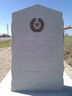
Site of Burnam's Ferry
First ferry in present-day Fayette County. Established about 1824 at the crossing of the La Bahia Road by Jesse Burnam. After the Army of the Republic of Texas crossed on March 19, 1836, the ferry was destroyed by order of General Sam Houston to prevent its use by the advancing Mexican Army.
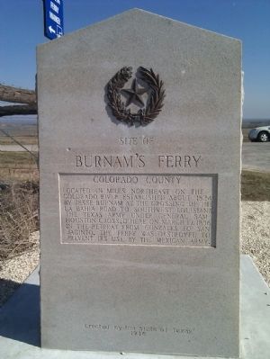
(reverse)
Colorado County
Located 1½ miles northeast on the Colorado River established about 1824 by Jesse Burnam at the crossing of the La Bahia Road to southwest Louisiana. The Texas Army under General Sam Houston crossed here on March 19, 1836 in the retreat from Gonzales to San Jacinto. The ferry was destroyed to prevent its use by the Mexican Army.
Erected 1936 by State of Texas. (Marker Number 575.)
Topics and series. This historical marker is listed in this topic list: War, Texas Independence. In addition, it is included in the Texas 1936 Centennial Markers and Monuments series list. A significant historical month for this entry is March 1753.
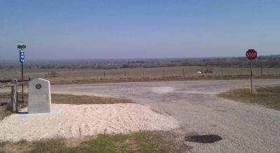
Location. 29° 48.125′ N, 96° 47.825′ W. Marker is near La Grange, Texas, in Fayette County. Marker is at the intersection of Farm to Market Road 155 and Anton Salas Loop, on the left when traveling north on Road 155. Touch for map. Marker is in this post office area: La Grange TX 78945, United States of America. Touch for directions.
Other nearby markers. At least 8 other markers are within 7 miles of this marker, measured as the crow flies. James J. Ross (approx. 5.4 miles away); Dubina (approx. 5˝ miles away); Old Osage (approx. 6˝ miles away); Cesko Narodni Hřbitov (approx. 6˝ miles away); The Holman-Seifert Homestead (approx. 6˝ miles away); St. Michael’s Catholic Church (approx. 6.7 miles away); Weimar Masonic Cemetery (approx. 7 miles away); Town of Weimar (approx. 7 miles away).
More about this marker. This marker was located in Colorado County for many years and was restored to Fayette County in 2010.
Also see . . .
1. Burnam's Ferry. The Handbook of Texas Online, Texas State Historical Association (Submitted on March 5, 2012, by Bernard Fisher of Richmond, Virginia.)
2. Burnam's Ferry Centennial Marker - The Story. From the Texas Escapes website. The story of the marker's journey, from its original placement in Fayette County in 1936, its alteration and removal to Colorado County in the 1970s, and its return and re-placement in Fayette County in 2010. (Submitted on June 25, 2016, by Duane Hall of Abilene, Texas.)
Credits. This page was last revised on June 25, 2016. It was originally submitted on March 4, 2012, by Gregory Walker of La Grange, Texas. This page has been viewed 1,128 times since then and 56 times this year. Photos: 1, 2, 3. submitted on March 4, 2012, by Gregory Walker of La Grange, Texas. • Bernard Fisher was the editor who published this page.


