Near Columbia in Tuolumne County, California — The American West (Pacific Coastal)
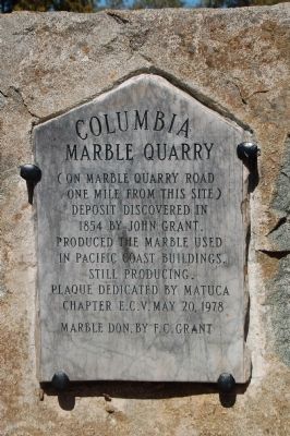
Columbia Marble Quarry
one mile from this site)
Deposit discovered in
1854 by John Grant.
Produced the marble used
in Pacific Coast buildings.
Still producing.
Erected 1978 by E Clampus Vitus, Matuca Chapter 1849, Marble Donated by F. C. Grant.
Topics and series. This historical marker is listed in these topic lists: Industry & Commerce • Natural Resources. In addition, it is included in the E Clampus Vitus series list. A significant historical year for this entry is 1854.
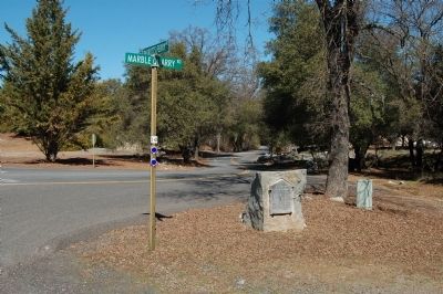
Location. 38° 3.052′ N, 120° 24.829′ W. Marker is near Columbia, California, in Tuolumne County. Marker is at the intersection of Parrots Ferry Road (County Route E18) and Marble Quarry Road, on the right when traveling north on Parrots Ferry Road. Touch for map. Marker is at or near this postal address: 23511 Parrots Ferry Road, Columbia CA 95310, United States of America. Touch for directions.
Other nearby markers. At least 8 other markers are within 2 miles of this marker, measured as the crow flies. Columbia Cemetery (approx. 1.1 miles away); Charles Crist Kress (approx. 1.2 miles away); To Honor the Chinese Pioneers (approx. 1.2 miles away); Columbia Masonic Cemetery (approx. 1.2 miles away); James Wood Coffroth (approx. 1.2 miles away); Columbia School House (approx. 1.2 miles away); Claverie Building (approx. 1.2 miles away); Bixel Brewery (approx. 1.3 miles away). Touch for a list and map of all markers in Columbia.
Also see . . . Columbia Marble Quarries. Details and history of the quarries located near Columbia. Includes current and historic photos. (Submitted on March 11, 2012.)
Credits. This page was last revised on June 16, 2016. It was originally submitted on March 8, 2012, by Barry Swackhamer of Brentwood, California. This page has been viewed 725 times since then and 49 times this year. Photos: 1, 2. submitted on March 8, 2012, by Barry Swackhamer of Brentwood, California. • Syd Whittle was the editor who published this page.

