Near Columbia in Tuolumne County, California — The American West (Pacific Coastal)
Inspiration Point
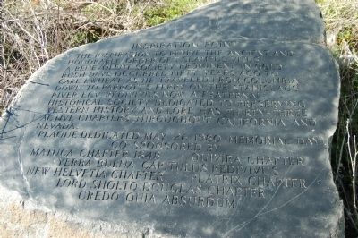
Photographed by Barry Swackhamer, March 3, 2012
1. Inspiration Point Marker
Erected 1980 by E Clampus Vitus (various chapters).
Topics and series. This historical marker is listed in this topic list: Fraternal or Sororal Organizations. In addition, it is included in the E Clampus Vitus series list.
Location. 38° 2.3′ N, 120° 26.854′ W. Marker is near Columbia, California, in Tuolumne County. It is on Parrots Ferry Road (County Road E18), on the left when traveling south. This marker is located at a vista point overlooking the Parrots Ferry Bridge. It is necessary to exit one's car and look over the guard rail to see this marker. Touch for map. Marker is in this post office area: Columbia CA 95310, United States of America. Touch for directions.

Regionally,
this page online
Other nearby markers. At least 8 other markers are within 3 miles of this marker, measured as the crow flies: Parrott’s Ferry (approx. half a mile away); Columbia Marble Quarry (approx. 2 miles away); Springfield Cemetery (approx. 2.1 miles away); Springfield (approx. 2.2 miles away); Columbia (approx. 2.4 miles away); James Wood Coffroth (approx. 2½ miles away); Hon. Jesse M. Mayo (approx. 2½ miles away); Columbia Masonic Temple (approx. 2½ miles away). Touch for a list and map of all markers in Columbia.
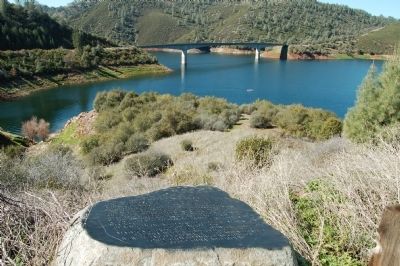
Photographed by Barry Swackhamer, March 3, 2012
2. Inspiration Point Marker
The Parrots Ferry Bridge is in the background.
Credits. This page was last revised on June 16, 2016. It was originally submitted on March 8, 2012, by Barry Swackhamer of Brentwood, California. This page has been viewed 746 times since then and 20 times this year. Photos: 1, 2. submitted on March 8, 2012, by Barry Swackhamer of Brentwood, California. • Syd Whittle was the editor who published this page.
