Near Lyons in Rice County, Kansas — The American Midwest (Upper Plains)
Santa Fe Trail
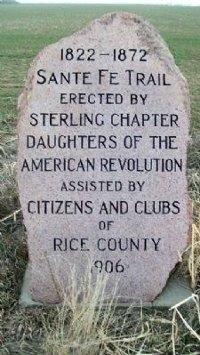
1822 - 1872
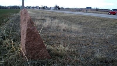
[Part of the markers denoting the route of the trail]
Erected 1906 by Sterling Chapter, Daughters of the American Revolution; and Citizens and Clubs of Rice County.
Topics and series. This historical marker is listed in these topic lists: Industry & Commerce • Roads & Vehicles • Settlements & Settlers. In addition, it is included in the Daughters of the American Revolution, and the Santa Fe Trail series lists.
Location. 38° 19.64′ N, 98° 12.12′ W. Marker is near Lyons, Kansas, in Rice County. Marker is on Broadway / 16th Road (State Highway 14/96) half a mile south of American Road, on the right when traveling south. Touch for map. Marker is in this post office area: Lyons KS 67554, United States of America. Touch for directions.
Other nearby markers. At least 8 other markers are within 8 miles of this marker, measured as the crow flies. Workman Park (approx. 1.4 miles away); Rice County Historical Mural (approx. 1.4 miles away); Civil War and Veterans Memorial (approx. 1.4 miles away); Cow Creek Station (approx. 4.3 miles away); Coronado and Quivira (approx. 4.3 miles away); Fray Juan de Padilla (approx. 4.3 miles away); Cooper Hall (approx. 7.3 miles away); Meade Post No 14 G.A.R. Memorial (approx. 8 miles away). Touch for a list and map of all markers in Lyons.
Also see . . .
1. Santa Fe National Historic Trail. (Submitted on March 9, 2012, by William Fischer, Jr. of Scranton, Pennsylvania.)
2. Santa Fe Trail Association. (Submitted on March 9, 2012, by William Fischer, Jr. of Scranton, Pennsylvania.)
Credits. This page was last revised on June 16, 2016. It was originally submitted on March 8, 2012, by William Fischer, Jr. of Scranton, Pennsylvania. This page has been viewed 531 times since then and 14 times this year. Photos: 1, 2. submitted on March 9, 2012, by William Fischer, Jr. of Scranton, Pennsylvania.

