Gateway Acres in Nashville in Davidson County, Tennessee — The American South (East South Central)
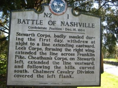
Battle of Nashville
Confederate Position
— Dec. 16, 1864 —
Erected by Tennessee Historical Commission. (Marker Number N2 1.)
Topics and series. This historical marker is listed in this topic list: War, US Civil. In addition, it is included in the Tennessee Historical Commission series list.
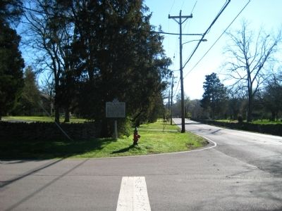
Location. 36° 5.189′ N, 86° 48.226′ W. Marker is in Nashville, Tennessee, in Davidson County. It is in Gateway Acres. Marker is at the intersection of Granny White Pike and Sewanee Road, on the right when traveling north on Granny White Pike. Touch for map. Marker is in this post office area: Nashville TN 37215, United States of America. Touch for directions.
Other nearby markers. At least 8 other markers are within walking distance of this marker. Dry-Stack Stone Walls (about 400 feet away, measured in a direct line); a different marker also named Battle of Nashville (about 600 feet away); Josephine Groves Holloway / Girl Scouts of Middle Tennessee (approx. 0.2 miles away); a different marker also named Battle of Nashville (approx. ¼ mile away); Minnesota (approx. 0.3 miles away); John Trotwood Moore (approx. 0.6 miles away); Monroe Harding (approx. 0.7 miles away); Granny White Grave (approx. 0.9 miles away). Touch for a list and map of all markers in Nashville.
Credits. This page was last revised on February 7, 2023. It was originally submitted on March 9, 2012, by Kevin Hoch of Waco, Texas. This page has been viewed 1,055 times since then and 36 times this year. Photos: 1, 2. submitted on March 9, 2012, by Kevin Hoch of Waco, Texas. • Craig Swain was the editor who published this page.

