Heath Springs in Lancaster County, South Carolina — The American South (South Atlantic)
The Battle Of The Hanging Rock
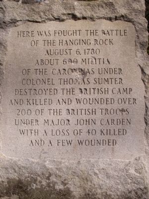
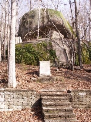
Here was fought the Battle of the Hanging Rock August 6, 1780. About 600 Militia of the Carolinas under Colonel Thomas Sumter destroyed the British Camp and killed and wounded over 200 of the British Troops under Major John Carden with a loss of 40 killed and a few wounded.
Erected 1948 by Waxhaw Chapter of the DAR.
Topics. This historical marker is listed in this topic list: War, US Revolutionary. A significant historical date for this entry is August 6, 1780.
Location. 34° 33.936′ N, 80° 39.715′ W. Marker is in Heath Springs, South Carolina, in Lancaster County. Marker can be reached from Hanging Rock Road (State Highway 29-467) 0.8 miles east of Flat Rock Road, on the right when traveling east. Within the Hanging Rock Battleground Property, managed by the SC State Park Service. Touch for map. Marker is in this post office area: Heath Springs SC 29058, United States of America. Touch for directions.
Other nearby markers. At least 8 other markers are within 5 miles of this marker, measured as the crow flies. James Ingram Home (approx. 0.6 miles away); Battle of Hanging Rock (approx. 1.8 miles away); Birthplace of Dr. James Marion Sims (approx. 2.8 miles away); Beaver Creek Skirmish / Capture of Provisions at Flat Rock (approx. 3.2 miles away); Birthplace of James Marion Sims, M.D. (approx. 3.9 miles away); Kershaw (approx. 4.2 miles away); Stoneboro (approx. 4.6 miles away); Welsh's Station / Kershaw Depot (approx. 4.7 miles away). Touch for a list and map of all markers in Heath Springs.
Also see . . .
1. Battle of Hanging Rock. Wikipedia article (Submitted on March 11, 2012, by Anna Inbody of Columbia, South Carolina.)
2. The American Revolution in South Carolina. (Submitted on March 11, 2012, by Anna Inbody of Columbia, South Carolina.)
Additional commentary.
1. The Hanging Rock State Historic Site
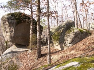
The Hanging Rock State Historic Site has served as a natural landmark for generations. However, this area is best known for its role in the American Revolution.
A British outpost was established in the area. In late July 1780, William Richardson Davie led a raid on the outpost taking horses and arms from the British forces. On August 6, 1780, General Thomas Sumter with 600 militiamen from the Carolinas attacked and looted the outpost which was garrisoned by 1400 British fighters. At the age of 13, President Andrew Jackson experienced the battle. This young boy, who went on to be the Hero of New Orleans, said that he learned his military skills from the brave men who fought at the Hanging Rock.
— Submitted March 11, 2012, by Anna Inbody of Columbia, South Carolina.
Credits. This page was last revised on November 2, 2023. It was originally submitted on March 11, 2012, by Anna Inbody of Columbia, South Carolina. This page has been viewed 2,428 times since then and 86 times this year. Last updated on November 1, 2023, by Ronald Patton of Lancaster, South Carolina. Photos: 1, 2, 3, 4, 5, 6, 7, 8. submitted on March 11, 2012, by Anna Inbody of Columbia, South Carolina. • Bernard Fisher was the editor who published this page.
