Osborne in Osborne County, Kansas — The American Midwest (Upper Plains)
Geodetic Center of North America
Photographed by William Fischer, Jr., August 28, 2011
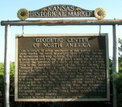
1. Geodetic Center of North America Marker
On a ranch 18 miles southeast of this marker a bronze plate marks the most important spot on this continent to surveyors and map makers. Engraved in the bronze is a cross-mark and on the tiny point where the lines cross depend the surveys of a sixth of the world's surface. This is the Geodetic Center of the United States, the "Primary Station" for all North American surveys. It was located in 1901 by the U.S. Coast and Geodetic Survey. Later Canada and Mexico adopted the point and its supporting system as the base for their surveys and it is now known as the "North American Datum." What Greenwich is to the longitude of the world, therefore, a Kansas pasture is to the lines and boundaries of this continent. It must not be confused with the Geographic Center of the United States, which is 42 miles north, in Smith County.
———————
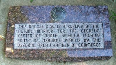
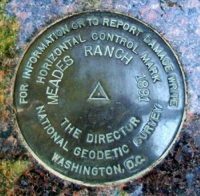
This bronze disc is a replica of the actual marker for the Geodetic Center of North America, located south of Osborne.
Erected by Kansas Historical Society, State Highway Commission and Osborne Area Chamber of Commerce. (Marker Number 38.)
Topics and series. This historical marker is
this page online
Location. 39° 27.137′ N, 98° 41.613′ W. Marker is in Osborne, Kansas, in Osborne County. It is on 80th Drive, on the right when traveling east. Marker is at a roadside rest area/park, about 300 feet east of North 1st Street (U.S. Hwy 24/281). Touch for map. Marker is in this post office area: Osborne KS 67473, United States of America. Touch for directions.

Regionally, this marker is in the Smoky Hills. It is also in the American Midwest, in the Corn Belt, on the prairies, and on the Southern Plains. Globally, it is in North America, the Western Hemisphere, the Western World, and the Anglosphere. Historically, it finds itself in what was once the Louisiana Purchase.
Other nearby markers. At least 8 other markers are within 9 miles of this marker, measured as the crow flies: Osborne / Solomon Valley Highway 24 Heritage Alliance (a few steps from this marker); Hardman Veterans Memorial Park (approx. 0.3 miles away); Osborne County Pioneers Memorial (approx. 1.1 miles
Photographed by William Fischer, Jr., August 28, 2011
2. Geodetic Center of North America Bronze Disc Replica and Marker
Also see . . . National Geodetic Survey. (Submitted on March 14, 2012, by William Fischer, Jr. of Reynoldsburg, Ohio.)
Photographed by William Fischer, Jr., August 28, 2011
3. Geodetic Center of North America Disc Replica
Photographed by William Fischer, Jr., August 28, 2011
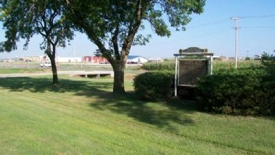
4. Geodetic Center of North America Marker
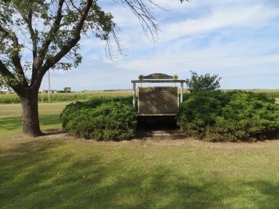
Photographed by Bill Kirchner, September 22, 2014
5. Geodetic Center of North America Marker

Photographed by Ian Lefkowitz, June 30, 2023
6. Geodetic Center of North America Bronze Disc Replica and Marker
Credits. This page was last revised on April 8, 2025. It was originally submitted on March 14, 2012, by William Fischer, Jr. of Reynoldsburg, Ohio. This page has been viewed 3,268 times since then and 206 times this year. Photos: 1, 2, 3, 4. submitted on March 14, 2012, by William Fischer, Jr. of Reynoldsburg, Ohio. 5. submitted on October 13, 2014, by Bill Kirchner of Tucson, Arizona. 6. submitted on March 27, 2025, by Ian Lefkowitz of New York, New York.
