Marker Logo HMdb.org THE HISTORICAL
MARKER DATABASE
“Bite-Size Bits of Local, National, and Global History”
Rockport in Aransas County, Texas — The American South (West South Central)
 

First National Bank of Rockport


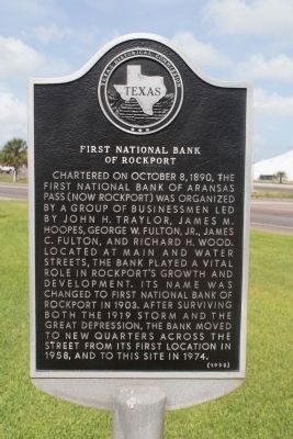
First National Bank of Rockport Marker image. Click for full size.
Photographed By Norman Frank, March 20, 2012
1. First National Bank of Rockport Marker
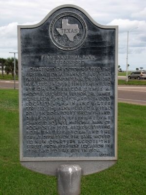
Inscription. Chartered on October 8, 1890, the First National Bank of Aransas Pass (now Rockport) was organized by a group of businessmen led by John H. Traylor, James M. Hoopes, George W. Fulton, Jr., James C. Fulton, and Richard H. Wood. Located at Main and Water Streets, the bank played a vital role in Rockport’s growth and development. Its name was changed to First National Bank of Rockport in 1903. After surviving both the 1919 storm and the Great Depression, the bank moved to new quarters across the street from its first location in 1958, and to this site in 1974.
 
Erected 1990 by Texas Historical Commission. (Marker Number 1799.)
 
Topics. This historical marker is listed in this topic list: Industry & Commerce. A significant historical month for this entry is October 1878.
 
Location. 28° 1.662′ N, 97° 2.971′ W. Marker is in Rockport, Texas, in Aransas County. Marker can be reached from East Liberty Street (Business State Highway 35) east of North Austin Street, on the left when traveling east. Located in the east parking lot of Wells Fargo Bank. Touch for map. Marker is at or near this postal address: 502 N Austin St, Rockport TX 78382, United States of America. Touch for directions.
 
Other nearby markers. At least 8 other markers are within walking distance of this marker. Hoopes-Smith House (within shouting distance of this marker); Fulton-Bruhl House (about 400 feet away, measured
Paid Advertisement
Click on the ad for more information.
Please report objectionable advertising to the Editor.
Click or scan to see
this page online
in a direct line); Woman’s Club of Aransas County Building (about 600 feet away); Bracht House (about 700 feet away); Rockport’s Harbor (about 800 feet away); Rockport’s Seafood Industry (approx. 0.2 miles away); Jackson Family Maritime Companies (approx. 0.2 miles away); Wood-Jackson House (approx. 0.2 miles away). Touch for a list and map of all markers in Rockport.
 
First National Bank of Rockport Marker image. Click for full size.
Photographed By Michael Heinich, July 7, 2014
2. First National Bank of Rockport Marker
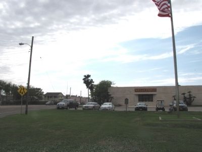
Wells Fargo Bank with marker in foreground image. Click for full size.
Photographed By Norman Frank, March 20, 2012
3. Wells Fargo Bank with marker in foreground
This is the view you'll see from Broadway/Business Highway 35.
 
 
Credits. This page was last revised on June 16, 2016. It was originally submitted on March 20, 2012. This page has been viewed 825 times since then and 18 times this year. Photos:   1. submitted on March 20, 2012.   2. submitted on July 11, 2014, by Michael Heinich of Austin, Texas.   3. submitted on March 20, 2012. • Bernard Fisher was the editor who published this page.
Share this page.  
Share on Tumblr
m=53748

CeraNet Cloud Computing sponsors the Historical Marker Database.
This website earns income from purchases you make after using our links to Amazon.com. We appreciate your support.
Paid Advertisement
Apr. 19, 2024