Chatham in Sangamon County, Illinois — The American Midwest (Great Lakes)
Pioneer Park
Photographed by Larry Senalik, March 26, 2012
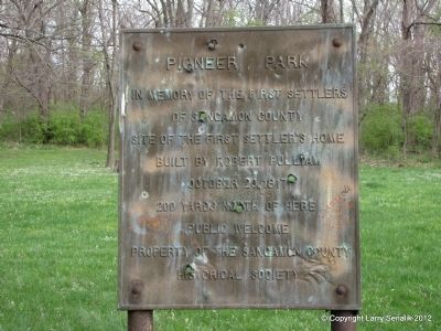
1. Pioneer Park Marker
of Sangamon County
Site of the first settler's home
built by Robert Pulliam
October 20, 1817
200 yards north of here
Public welcome
Property of the Sangamon County
Historical Society
Erected by Sangamon County Historical Society.
Topics. This historical marker is listed in this topic list: Settlements & Settlers. A significant historical date for this entry is October 20, 1817.
Location. 39° 38.424′ N, 89° 39.742′ W. Marker is in Chatham, Illinois, in Sangamon County. It can be reached from Covered Bridge Road 0.2 miles west of Old Indian Trail, on the right when traveling west. Touch for map. Marker is at or near this postal address: 694 Covered Bridge Road, Glenarm IL 62536, United States of America. Touch for directions.

Regionally, this marker is in Central Illinois and in Greater Springfield. It is also in the American Midwest and in the Corn Belt. Globally, it is in North America, the Western Hemisphere, the Western World, and the Anglosphere. Historically, it finds itself in what was once the territory of the Mississippian Culture and also the Northwest Territory.
Other nearby markers. At
this page online
Also see . . . "Hero or hellion? The life and times of Robert Pulliam, patriarch of Sangamon County". Illinois Times article, June 24, 2004 (Submitted on March 27, 2012, by Larry Senalik of Pleasant Plains, Illinois.)
Photographed by Larry Senalik, March 26, 2012
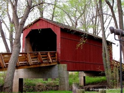
2. Sugar Creek Covered Bridge
Covered Bridge built in 1880 that is preserved in the park.
Photographed by Larry Senalik, March 26, 2012
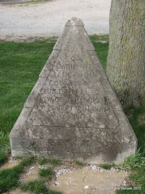
3. Stone Marker
This marker is also related to the first cabin in Sangamon County but is on Old Indian Trail.
Credits. This page was last revised on September 3, 2025. It was originally submitted on March 27, 2012, by Larry Senalik of Pleasant Plains, Illinois. This page has been viewed 1,442 times since then and 70 times this year. Photos: 1, 2, 3. submitted on March 27, 2012, by Larry Senalik of Pleasant Plains, Illinois. • Bernard Fisher was the editor who published this page.
