Near Pineville in Berkeley County, South Carolina — The American South (South Atlantic)
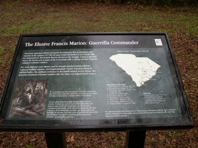
The Elusive Francis Marion: Guerrilla Commander
Photographed by Anna Inbody, March 24, 2012
1. The Elusive Francis Marion: Guerrilla Commander Marker
For more than two years Marion and his brigade attacked enemy columns, captured isolated outposts, and fought alongside American forces in pitched battles. His stubborn resistance to the British helped secure victory. His generous treatment of former Loyalists after the bitter war helped ensure peace.
Erected by South Carolina State Park Service.
Topics. This historical marker is listed in these topic lists: Patriots & Patriotism • War, US Revolutionary. A significant historical year for this entry is 1780.
Location. 33° 27.245′ N, 80° 5.2′ W. Marker is near Pineville, South Carolina, in Berkeley County. It is on General Francis Marion Avenue, on the left when traveling north. Touch for map. Marker is in this post office area: Pineville SC 29468, United States of America. Touch for directions.

Regionally,
this page online
Other nearby markers. At least 8 other markers are within 5 miles of this marker, measured as the crow flies: The Elusive Francis Marion: The Stuff of Legend (within shouting distance of this marker); Francis Marion’s Grave (within shouting distance of this marker); Francis Marion / Francis Marion's Grave (approx. one mile away); Maude E. Callen Clinic (approx. 1.8 miles away); Village of Eadytown (approx. 2.1 miles away); Village of Pineville (approx. 3.8 miles away); Maham Plantation / Col. Hezekiah Maham (approx. 3.9 miles away); Maham Plantation (approx. 4.2 miles away). Touch for a list and map of all markers in Pineville.
Photographed by Anna Inbody, March 24, 2012
2. Overview
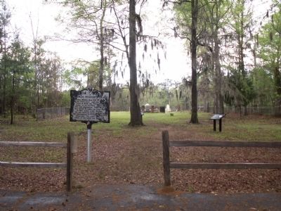
The marker can be seen to the right and slightly behind the State Roadside Marker.
Photographed by Anna Inbody, March 24, 2012
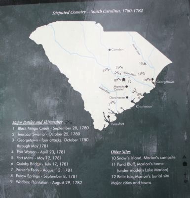
3. Map on the marker
A partisan leader's far-flung territory: Maneuvering on horseback, often at night, combined with an intimate knowledge of the countryside let Marion and his brigade quickly cover long distances and elude pursuit.
Photographed by Anna Inbody, March 24, 2012
4. Picture on the marker
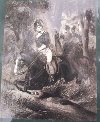
No contemporary artist ever painted a portrait of Marion, but this 19th century engraving comes close to the description written by William Dobein James, a teenage soldier in his brigade:
"He was rather below the middle stature of men, lean and swarthy. His body was well set but his knees and ankles were badly formed; and he still limped upon one leg. He had a countenance remarkably steady; his nose was aquiline, his chin projecting; his forehead large and high, and his eyes black and piercing. He was now forty-eight years of age, but still even at this age, his frame was capable of enduring fatigue and every privation, necessary for a partisan."
"He was rather below the middle stature of men, lean and swarthy. His body was well set but his knees and ankles were badly formed; and he still limped upon one leg. He had a countenance remarkably steady; his nose was aquiline, his chin projecting; his forehead large and high, and his eyes black and piercing. He was now forty-eight years of age, but still even at this age, his frame was capable of enduring fatigue and every privation, necessary for a partisan."
Credits. This page was last revised on June 16, 2016. It was originally submitted on March 28, 2012, by Anna Inbody of Columbia, South Carolina. This page has been viewed 1,869 times since then and 46 times this year. Photos: 1, 2, 3, 4. submitted on March 28, 2012, by Anna Inbody of Columbia, South Carolina. • Craig Swain was the editor who published this page.
