New Market in Frederick County, Maryland — The American Northeast (Mid-Atlantic)
Mile Stones of the old National Pike
— The Historic National Road - The Road That Built The Nation —
Inscription.
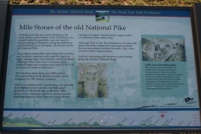
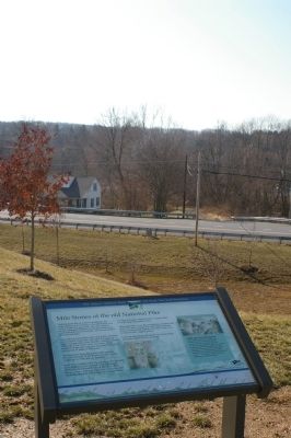
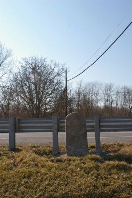
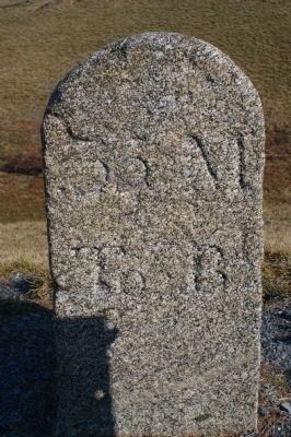
Looking more like an ancient tombstone, the stone marker at the bottom of the hill before you, tucked inside the guardrail, was once used to denote mileage to Baltimore along the Baltimore and Frederick-Town Turnpike, also known as the old National Pike.
Long before automobiles sped along this corridor and synthetic materials were used for highway signs, mileage signs were literally carved in stone! Although it has worn away over time, handchiseled letters and numbers once read 35 M To B, and meant 35 miles to Baltimore.
This tradition dates back over 2000 years to the road builders of the Roman Empire, and it continued in 19th century America.
Forty-five markers were placed along the turnpike from Baltimore to Frederick, one mile apart, primarily on the north side of the road. Mile stones were a welcome sign for a weary traveler plodding along at a slow pace in a horse-drawn carriage or wagon. Heavily laden wagons often covered only a few miles a day.
Although built to last, the permanency of some mile stones has been usurped by road improvements that accommodated modern travelers. Only a few remain in their original places.
Look for remaining mile stones on your journey along the Historic National Road.
(Sidebar):
Traffic Jams Are Nothing New
This stretch of the National Pike once bustled with merchants and farmers transporting raw materials and farm products in horse-drawn wagons to markets in the east. James Buckingham, an early traveler on the road, described his fellow passengers as “being farmers, country dealers, and speculators, passing from town to town” and noted a “spirit of mutual forbearance and good nature.”
Erected by America's Byways.
Topics and series. This historical marker is listed in this topic list: Roads & Vehicles. In addition, it is included in the The Historic National Road series list. A significant historical year for this entry is 2000.
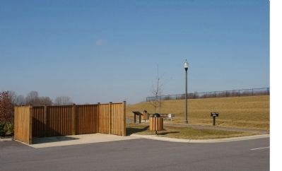
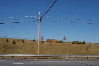
Location. 39° 22.645′ N, 77° 13.876′ W. Marker is in New Market, Maryland, in Frederick County. Marker can be reached from Old National Pike (Maryland Route 144), on the right when traveling west. The marker is located within Old National Pike District Park. To get to the marker, turn into the park and then turn left into the first parking lot. The marker is at the far end of the parking lot. Touch for map. Marker is at or near this postal address: 12406 Old National Pike, Mt Airy, MD 21771, New Market MD 21774, United States of America. Touch for directions.
Other nearby markers. At least 8 other markers are within 3 miles of this marker, measured as the crow flies. New Market (approx. 2.1 miles away); 3 West Main Street (approx. 2.1 miles away); 5 West Main Street (approx. 2.1 miles
away); 9 West Main Street (approx. 2.1 miles away); New Market in the Civil War (approx. 2.1 miles away); 13 West Main Street (approx. 2.1 miles away); a different marker also named New Market (approx. 2.2 miles away); The Town of New Market (approx. 2.2 miles away). Touch for a list and map of all markers in New Market.
More about this marker. In the center of the marker is a photo of a milestone displaying "35 M to B." In the sidebar is a photo of coaches and wagons on their way up the National Road. The background of the marker is "National Road at Fairview Inn" which is the standard for markers in this series. An elevation diagram of the national road is displayed on the bottom of the marker's face.
Also see . . . The National Pike and National Road. This correspondent's blog offers some detailed information about the National Road. Google Maps interfaces with plotted locations of the milestones in Maryland are linked to photos where they exist (or have been located). (Submitted on February 15, 2008, by Craig Swain of Leesburg, Virginia.)
Additional commentary.
1. Comments about the Marker's Text
There are several inaccuracies in the text on the marker.
It suggests that the text on the marker has been completely worn away, which is not true - it is unreadable at many times of the day, but under proper lighting, it is quite ledgible.
The text also suggests that the stones were primarily placed on the north side of the road. The word "primarily" does not seem sufficiently strong. Of the extant milestones between Baltimore and Cumberland, all but one, milestone 5 M to B, are on the north side of the road. It is strongly suspected that milestone 5 may have been moved to the south side of the road when it was straightened or realigned. Further, I have not seen any historical evidence to document their placement on the south side of the road.
Finally, the text suggests that very few of the markers are anywhere close to where they should be. Of the 45 milestones between Baltimore and Frederick, 35 (78%) are still extant. While they may not be precisely in their original locations, due primarily to road widening, they are, with one exception, within about 100 feet of where they were originally placed, and generally much closer to their original placement than that.
— Submitted February 15, 2008.
Credits. This page was last revised on March 24, 2024. It was originally submitted on February 15, 2008, by Christopher Busta-Peck of Shaker Heights, Ohio. This page has been viewed 3,125 times since then and 99 times this year. Photos: 1, 2, 3. submitted on February 15, 2008, by Christopher Busta-Peck of Shaker Heights, Ohio. 4. submitted on February 24, 2008, by Christopher Busta-Peck of Shaker Heights, Ohio. 5, 6. submitted on February 15, 2008, by Christopher Busta-Peck of Shaker Heights, Ohio. • Craig Swain was the editor who published this page.
