Thorold in Niagara Region, Ontario — Central Canada (North America)
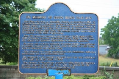
In Memory of John Bean, Ph.D., M.D.
John did extensive research, and became a world leader in the field of oxygen poisoning, particularly during World War II, when the subject had extensive applications in undersea operations.
He wrote and co-wrote hundreds of articles which were published in medical journals over the years, some of which are still being used as references and quoted today.
John belonged to several organizations and committees, both on a professional and non-professional level.
He continued to do research and work part-time after retiring in 1972, right up til his death in 1987.
The citizens of Thorold are grateful to John Bean for leaving a generous bequest in his will to the City of Thorold for the beautification of the Battle of Beaverdams Park.
Topics. This historical marker is listed in these topic lists: Education • Science & Medicine • War, World II. A significant historical month for this entry is September 1869.
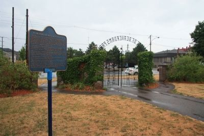
Location. 43° 7.381′ N, 79° 12.103′ W. Marker is in Thorold, Ontario, in Niagara Region. Marker is on Sullivan Avenue just south of Towpath Road, on the right when traveling east. This historic marker is located in Beaversdam Battlefield Park, near the north entrance to the park, along a walking trail that runs north to south through the park, just southwest of the downtown business district. Touch for map. Marker is at or near this postal address: 8 Sullivan Avenue, Thorold ON L2V 2Y2, Canada. Touch for directions.
Other nearby markers. At least 8 other markers are within 5 kilometers of this marker, measured as the crow flies. Arthur S. Whelan (a few steps from this marker); Beaver Dams (within shouting distance of this marker); Laura Ingersoll Secord (within shouting distance of this marker); In Memory of Unknown American Soldiers (within shouting distance of this marker); The Founding of Thorold (about 150 meters away, measured in a direct line); Old Thorold Firehall (about 240 meters away); Lock 24 - First Welland Canal (approx. 1.4 kilometers away); Vertical Lift Bridges (approx. 3.6 kilometers away). Touch for a list and map of all markers in Thorold.
Credits. This page was last revised on January 1, 2020. It was originally submitted on April 4, 2012, by Dale K. Benington of Toledo, Ohio. This page has been viewed 1,034 times since then and 14 times this year. Photos: 1, 2. submitted on April 4, 2012, by Dale K. Benington of Toledo, Ohio.

