Belleville in Essex County, New Jersey — The American Northeast (Mid-Atlantic)
School Number One
Photographed by Bill Coughlin, April 6, 2012
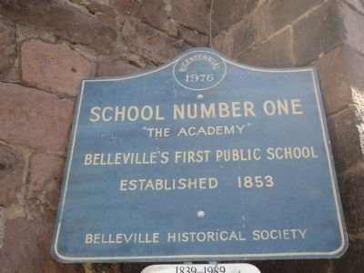
1. School Number One Marker
Belleville’s First Public School
Established 1853
Belleville Historical Society
Erected 1976 by Belleville Historical Society.
Topics. This historical marker is listed in this topic list: Education. A significant historical year for this entry is 1853.
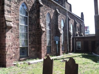
Location. 40° 47.196′ N, 74° 8.946′ W. Marker is in Belleville, New Jersey, in Essex County. It can be reached from the intersection of Belleville Tnpk (New Jersey Route 7) and Main Street, on the left when traveling west. Mareker is in the cemetery behind the Belleville Reformed Church. Touch for map. Marker is at or near this postal address: 171 Main Street, Belleville NJ 07109, United States of America. Touch for directions.

Regionally, this marker is in New Jersey’s North Jersey, in Greater Newark, and in the New York City Metropolitan Area. It is also in the American Northeast, in the Mid-Atlantic, and on the Eastern Seaboard. Globally, it is in the North Atlantic Region, North America, the Western Hemisphere, the Western World, and the Anglosphere. Historically, it finds itself in what was once New Netherland and also one
this page online
Other nearby markers. At least 8 other markers are within walking distance of this marker: Belleville Reformed Church Cemetery (a few steps from this marker); Revolutionary War Soldiers Monument (a few steps from this marker); The Dutch Church (within shouting distance of this marker); Josiah Hornblower (within shouting distance of this marker); The Rutgers Bridge (about 300 feet away, measured in a direct line); Belleville First Fire House (about 500 feet away); LCpl Osbrany Montes de Oca Bridge (about 600 feet away); Route 7 Bridge (about 600 feet away). Touch for a list and map of all markers in Belleville.
Also see . . . Village of Second River – Belleville, NJ. (Submitted on April 6, 2012, by Bill Coughlin of Woodland Park, New Jersey.)
Photographed by Bill Coughlin, April 6, 2012
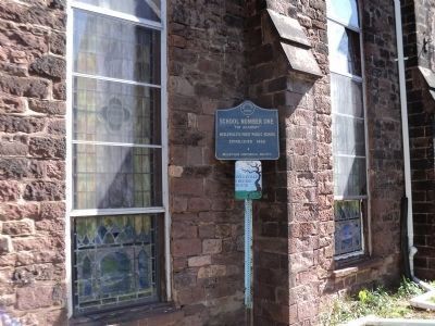
2. Belleville Marker
The marker is part of the 1839-1989 Belleville Historic Route (see lower marker).
Photographed by Bill Coughlin, April 6, 2012
3. School Number One Marker
Photographed by Bill Coughlin, April 6, 2012
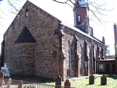
4. Marker in the Dutch Church Cemetery
The School Number One marker can be seen next to the church.
Photographed by Bill Coughlin, April 6, 2012
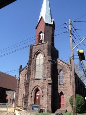
5. Belleville Reformed Church
The marker is located in the cemetery behind this 1697 Dutch Church.
Photographed by Bill Coughlin, April 6, 2012
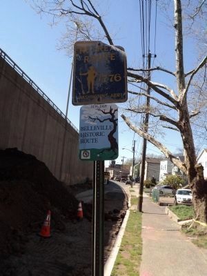
6. 1776 Retreat Route
Gen. George Washington's army passed the site of School Number One in 1776 when they were retreating across New Jersey. This event is noted by a series of signs such as this one in front of the Dutch Church.
Credits. This page was last revised on June 16, 2016. It was originally submitted on April 6, 2012, by Bill Coughlin of Woodland Park, New Jersey. This page has been viewed 959 times since then and 45 times this year. Photos: 1, 2, 3, 4, 5, 6. submitted on April 6, 2012, by Bill Coughlin of Woodland Park, New Jersey.
