near Callahan in Nassau County, Florida — The American South (South Atlantic)
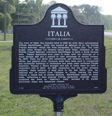
Italia
Photographed by Mike Stroud, March 30, 2012
1. Italia Marker
this page online
Erected 2012 by A Florida Heritage Site Sponsored by the Friends of Italia and the Florida Department of State. (Marker Number F-731.)
Topics. This historical marker is listed in these topic lists: Industry & Commerce • Settlements & Settlers. A significant historical year for this entry is 1882.
Location. 30° 36.939′ N, 81° 43.093′ W. Marker is in near Callahan, Florida, in Nassau County. It is on The Buccaneer Trail (State Road 200) (State Road A1A) near near Rocking Horse Lane, on the right when traveling west. Touch for map. Marker is in this post office area: Callahan FL 32011, United States of America. Touch for directions.

Regionally, this marker is in First Coast and in Greater Jacksonville. It is also in the American South and on the Eastern Seaboard. Globally, it is in the North Atlantic Region, North America, a Gulf of Mexico state, the Western Hemisphere, the Western World, and the Anglosphere. Historically, it finds itself in what was once New Spain, the territory of the Mississippian Culture, one of the Confederate States of America,
Photographed by Mike Stroud, March 30, 2012
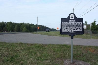
2. Italia Marker, looking west along State Road A1A
Other nearby markers. At least 8 other markers are within 5 miles of this marker, measured as the crow flies: Jacksonville National Cemetery (approx. 4.8 miles away); The Ultimate Sacrifice (approx. 4.8 miles away); Address by President Lincoln (approx. 4.8 miles away); The Carillon (approx. 4.8 miles away); Freedom is Not Free (approx. 4.8 miles away); Sky Soldiers (approx. 4.8 miles away); Navy Seabees (approx. 4.8 miles away); Pearl Harbor (approx. 4.9 miles away).
Photographed by Mike Stroud, March 30, 2012
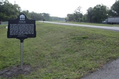
3. Italia Marker, seen looking east along State Road A1A
Credits. This page was last revised on June 16, 2016. It was originally submitted on April 7, 2012, by Mike Stroud of Bluffton, South Carolina. This page has been viewed 1,650 times since then and 89 times this year. Photos: 1, 2, 3. submitted on April 7, 2012, by Mike Stroud of Bluffton, South Carolina.
