Zion Crossroads in Louisa County, Virginia — The American South (Mid-Atlantic)
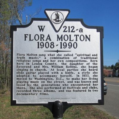
Flora Molton
1908-1990
Erected 2007 by Department of Historic Resources. (Marker Number W-212-a.)
Topics and series. This historical marker is listed in these topic lists: African Americans • Arts, Letters, Music • Entertainment • Women. In addition, it is included in the Virginia Department of Historic Resources (DHR) series list. A significant historical year for this entry is 1937.
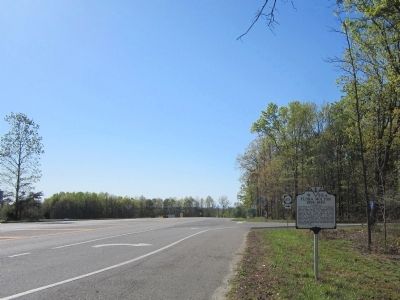
Location. 37° 58.309′ N, 78° 13.33′ W. Marker is in Zion Crossroads, Virginia, in Louisa County. Marker is at the intersection of Richmond Road (U.S. 250) and Zion Road (Virginia Route 627), on the right when traveling west on Richmond Road. Touch for map . Marker is in this post office area: Gordonsville VA 22942, United States of America. Touch for directions.
Other nearby markers. At least 8 other markers are within 7 miles of this marker, measured as the crow flies. Louisa County / Fluvanna County (about 600 feet away, measured in a direct line); a different marker also named Louisa County / Fluvanna County (approx. 0.2 miles away); Campaign of 1781 (approx. 3.2 miles away); The “Regular” Methodist Conference (approx. 6 miles away); a different marker also named Campaign of 1781 (approx. 6.6 miles away); Albemarle County / Louisa County (approx. 6.6 miles away); Revolutionary War Campaign of 1781 (approx. 6.6 miles away); Boswell’s Tavern (approx. 7.1 miles away). Touch for a list and map of all markers in Zion Crossroads.
Credits. This page was last revised on March 5, 2024. It was originally submitted on April 8, 2012, by Bernard Fisher of Richmond, Virginia. This page has been viewed 728 times since then and 29 times this year. Photos: 1, 2. submitted on April 8, 2012, by Bernard Fisher of Richmond, Virginia.

