
Near Bar Harbor in Hancock County, Maine — The American Northeast (New England)
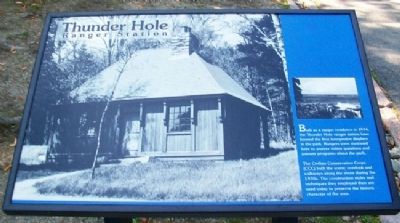
Thunder Hole Ranger Station
Photographed by William Fischer, Jr., September 21, 2011
1. Thunder Hole Ranger Station Marker
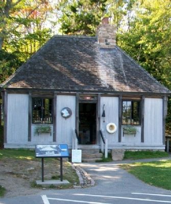
Built as a ranger residence in 1934, the Thunder Hole ranger station later housed the first interpretive displays in the park. Rangers were stationed here to answer visitor questions and present programs about the park.
The Civilian Conservation Corps (CCC) built the scenic overlook and walkways along the shore during the 1930s. The construction styles and techniques they employed then are used today to preserve the historic character of the area.
Erected by National Park Service.
Topics and series. This historical marker is listed in this topic list: Charity & Public Work. In addition, it is included in the Civilian Conservation Corps (CCC) series list. A significant historical year for this entry is 1934.
Location. 44° 19.259′ N, 68° 11.369′ W. Marker is near Bar Harbor, Maine, in Hancock County. It can be reached from Park Loop Road. Marker is at the Thunder Hole parking area, off Park Loop Road in Acadia National Park. Touch for map. Marker is at or near this postal address: 1411 Park Loop Rd, Bar Harbor ME 04609, United States of America. Touch for directions.

Regionally, this marker is on Mount Desert Island
this page online
Other nearby markers. At least 8 other markers are within walking distance of this marker: What Do Park Rangers Do? (within shouting distance of this marker); Sounds of the Sea (within shouting distance of this marker); Icy Depths (within shouting distance of this marker); Thunder Hole (about 400 feet away, measured in a direct line); “Hot Line” to Europe (approx. half a mile away); Alessandro Fabbri, Lieutenant, U.S.N.R.F. (approx. 0.6 miles away); Once a Busy Waterfront (approx. 0.6 miles away); Satterlee Field (approx. 0.6 miles away). Touch for a list and map of all markers in Bar Harbor.
Also see . . . Acadia National Park. (Submitted on April 14, 2012, by William Fischer, Jr. of Reynoldsburg, Ohio.)
Photographed by William Fischer, Jr., September 21, 2011
2. Thunder Hole Ranger Station and Marker
Credits. This page was last revised on September 23, 2020. It was originally submitted on April 14, 2012, by William Fischer, Jr. of Reynoldsburg, Ohio. This page has been viewed 841 times since then and 15 times this year. Photos: 1, 2. submitted on April 14, 2012, by William Fischer, Jr. of Reynoldsburg, Ohio.
