Oriskany in Oneida County, New York — The American Northeast (Mid-Atlantic)
Preserving a Memorial Park
Photographed by Dale K. Benington, July 29, 2011
1. Preserving a Memorial Park Marker
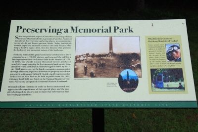
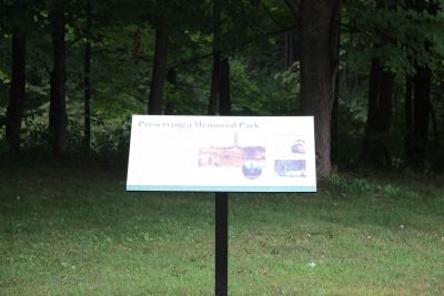
Oriskany Battlefield's grand centennial celebration in 1877 attracted nearly 70,000 visitors and renewed the call for a lasting monument to Herkimer's valor in the Summer of 1777. In 1880, the Oneida County Historical Society purchased nearly five acres, creating the first memorial park on site. Construction of the Herkimer monument began in 1883. By 1927, the 150th anniversary of the battle was again commemorated through elaborate pageantry wherein the property's deed was presented to Governor Alfred E. Smith, signifying its transfer to the State of New York to be held in public trust. By 1962, Oriskany Battlefield was listed on the National Register of Historic Places and designated a National Historic Landmark.
Research
this page online
Why Did You Come to Oriskany Battlefield Today?
Some people visit Oriskany Battlefield to reflect on its hallowed ground or to enjoy its natural beauty and the serenity of this place. Others come to study the logistics of the battle. Still others come to honor the memories and sacrifices of those who fought in 1777.
Topics. This historical marker is listed in this topic list: Landmarks. A significant historical year for this entry is 1877.
Location. 43° 10.513′ N, 75° 22.023′ W. Marker is in Oriskany, New York, in Oneida County. It can be reached from Rome Oriskany Road (New York State Route 69) 0.4 miles east of Monument Road. This historic marker is located in the eastern half of the Oriskany Battlefield State Historic Site park, next to several commemorative monuments, and can only be reached by walking. Touch for map. Marker is in this post office area: Oriskany NY 13424, United States of America. Touch for directions.

Regionally,
Photographed by Dale K. Benington, July 29, 2011
2. Preserving a Memorial Park Marker
Other nearby markers. At least 8 other markers are within walking distance of this marker: To The Unknown Patriotic Soldiers of Tryon County (a few steps from this marker); General Herkimer's Troops (within shouting distance of this marker); Ambush Started Here (about 300 feet away, measured in a direct line); The Military Road (about 400 feet away); The Ambush: August 6, 1777 (about 500 feet away); Aftermath of a Tragedy (about 600 feet away); Near This Spot (about 600 feet away); The Rally (approx. 0.2 miles away). Touch for a list and map of all markers in Oriskany.
Other markers no longer nearby. Campaign of 1777 (was within shouting distance of this marker but has been confirmed missing); The military road and the ravine
Photographed by Dale K. Benington, July 29, 2011
3. Preserving a Memorial Park Marker
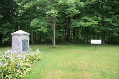
View of the historic marker located close to a commemorative battlefield monument.
Photographed by Dale K. Benington, July 29, 2011
4. Preserving a Memorial Park Marker
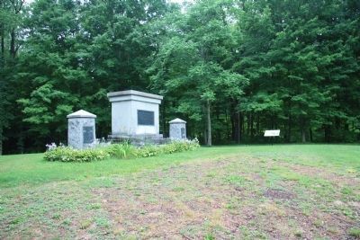
View of the historic marker located next to several commemorative battlefield monuments.
Credits. This page was last revised on June 16, 2016. It was originally submitted on April 14, 2012, by Dale K. Benington of Toledo, Ohio. This page has been viewed 552 times since then and 21 times this year. Photos: 1, 2, 3, 4. submitted on April 14, 2012, by Dale K. Benington of Toledo, Ohio.
