
Big Pine in Inyo County, California — The American West (Pacific Coastal)
Big Pine Veterans Memorial

Photographed by Craig Baker, October 30, 2025
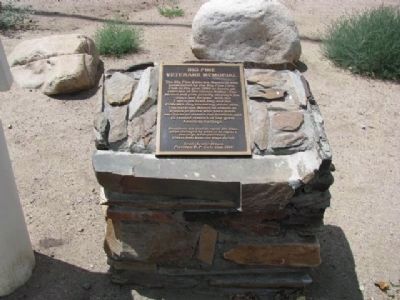
1. Big Pine Veterans Memorial
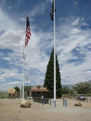
The Big Pine Veterans Memorial was established by the Big Pine Civic Club in the year 2000 to honor all veterans of the Owens Valley. The 80-foot tall pole proudly displays the "Stars and Stripes" with the California State flag and the POW/MIA flag bordering either side. The Veterans Memorial stands in tribute to those who have made sacrifices to ensure our freedom and to remind visitors of our great American heritage.
Donations are used to repair the flags when damaged by wind or to replace the flags when necessary. Please help keep our flags flying!
This memorial is dedicated to honor the men and women of our Armed Forces for their unconditional sacrifice and dedication to this great nation.
Thank you for our freedom.
God Bless You
Erected 2000 by Scott (Scotty) Wilson - President B.P. Civic Club.
Topics. This historical marker and memorial is listed in this topic list: Military. A significant historical year for this entry is 2000.
Location. 37° 10.398′ N, 118° 17.388′ W. Marker is in Big Pine, California, in Inyo County. It is at the intersection of Three Flags Highway (State Highway 395) and County Route
this page online

Regionally, this marker and memorial is in California’s Sierra Nevada. It is also in the American Mountain West. Globally, it is in North America, on the Ring of Fire, in the Pacific Rim, in the Western Hemisphere, in the Western World, and in the Anglosphere. Historically, it finds itself in what was once New Spain and also Mexico’s Alta California.
Other nearby markers. At least 8 other markers are within 14 miles of this marker, measured as the crow flies: Westgaard Pass Toll Road (here, next to this marker); The Roosevelt Tree (here, next to this marker); Inyo County Hospital and Farm (approx. 0.6 miles away); Big Pine Cemetery District (approx. 0.7 miles away); Zurich Station (approx. 1.7 miles away); Keough’s Hot Springs (approx. 7.4 miles away); From Trail to Highway (approx. 8 miles away); Schober Lane Campground (approx. 13.3 miles
Photographed by Denise Boose, August 5, 2009
2. Big Pine Veterans Memorial Marker

Photographed by Craig Baker, October 30, 2025
3. Memorial Dedication

Photographed by Craig Baker, October 30, 2025
4. Big Pine Veterans Memorial Marker
Photographed by Denise Boose, August 5, 2009
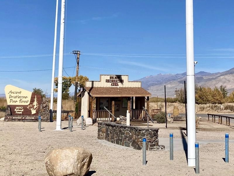
5. Big Pine Veterans Memorial
Next to the Roosevelt Tree, Big Pine Recreation Area Kiosk and Westgaard Pass Toll Road Marker.
Photographed by Craig Baker, October 30, 2025
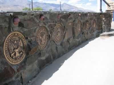
6. Big Pine Veterans Memorial
Photographed by Denise Boose, August 5, 2009
7. Big Pine Veterans Memorial
On top of the memorial is an etched plate of the mountain landscape.
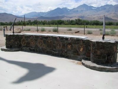
Photographed by Denise Boose, August 5, 2009
8. Big Pine Veterans Memorial
Etched plate of mountain landscapes on top.
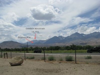
Photographed by Denise Boose, August 5, 2009
9. Mountain Landscapes #1
Steckler Flat & Goodale Mountain 12,772
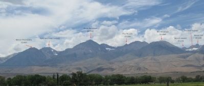
Photographed by Denise Boose
10. Mountain Landscapes #2
Mount Tinnemaha, Split Mountain, Birch Mountain, The Thumb, Kid Mountain, Mount Jepson, Palisade Glaciers and Mount Sill
Photographed by Denise Boose, August 5, 2009
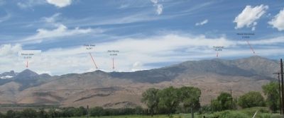
11. Mountain Landscapes #3
Mount Alice, Piper Peak, Sky Haven, Sugarloaf, and Round Mountain
Credits. This page was last revised on November 11, 2025. It was originally submitted on April 14, 2012, by Denise Boose of Tehachapi, California. This page has been viewed 1,007 times since then and 25 times this year. Photos: 1. submitted on November 11, 2025, by Craig Baker of Sylmar, California. 2. submitted on April 14, 2012, by Denise Boose of Tehachapi, California. 3, 4. submitted on November 11, 2025, by Craig Baker of Sylmar, California. 5. submitted on April 14, 2012, by Denise Boose of Tehachapi, California. 6. submitted on November 11, 2025, by Craig Baker of Sylmar, California. 7, 8, 9, 10, 11. submitted on April 14, 2012, by Denise Boose of Tehachapi, California. • Syd Whittle was the editor who published this page.
