Middletown Township near Highlands in Monmouth County, New Jersey — The American Northeast (Mid-Atlantic)
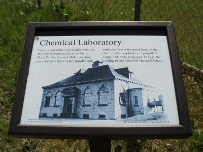
Chemical Laboratory
Photographed by Bill Coughlin, April 14, 2012
1. Chemical Laboratory Marker
This is the eighteenth in a series of 39 markers on the Fort Hancock Walking Tour.
Cannon and artillery projectiles were not the only weapons tested at the Sandy Hook Proving Ground. Rifles, machine guns, and new types of gun powder and explosive fuses were tested there. At the chemistry lab, explosive and propellant compounds were developed. In 1935, the building became the Fort Hancock School.
Sandy Hook Proving Ground operated from 1874 to 1919. Fort Hancock was in operation from 1895 to 1974.
Erected by Gateway National Recreation Area. (Marker Number 18.)
Topics and series. This historical marker is listed in these topic lists: Forts and Castles • Notable Buildings. In addition, it is included in the New Jersey - Fort Hancock Walking Tour series list. A significant historical year for this entry is 1935.
Location. 40° 28.086′ N, 74° 0.38′ W. Marker is near Highlands, New Jersey, in Monmouth County. It is in Middletown Township. It is at the intersection of Kearney Road and Canfield Road, on the left when traveling north on Kearney Road. Marker is located in the Fort Hancock area in the Sandy Hook Unit of Gateway National Recreation Area. Touch for map. Marker is in this post office area:
this page online

Regionally, this marker is in Central Jersey, specifically on the Jersey Shore, and in the New York City Metropolitan Area. It is also in the American Northeast, in the Mid-Atlantic, and on the Eastern Seaboard. Globally, it is in the North Atlantic Region, North America, the Western Hemisphere, the Western World, and the Anglosphere. Historically, it finds itself in what was once New Netherland and also one of the original Thirteen Colonies.
Other nearby markers. At least 8 other markers are within walking distance of this marker: Locomotive Engineer’s House (here, next to this marker); Proving Ground Foreman’s House (about 300 feet away, measured in a direct line); Site of Master Mechanic’s Quarters (about 400 feet away); Barracks, School, Headquarters (about 600 feet away); Hasty Additions in Wartime (about 700 feet away); Fort Hancock Officers’ Club (approx. 0.2 miles away); The World War II Years (approx. 0.2 miles away); Rodman Gun (approx. 0.2 miles away). Touch for a list and map of all markers in Highlands.
More about this marker. The background
Photographed by Bill Coughlin, April 14, 2012
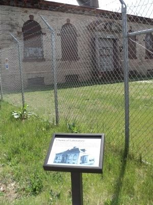
2. Marker at Fort Hancock
Photographed by Bill Coughlin, April 14, 2012
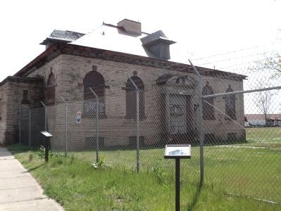
3. Chemical Laboratory Marker
The Chemical Laboratory is on Coast Guard property and is not open to the public.
Credits. This page was last revised on February 7, 2023. It was originally submitted on April 15, 2012, by Bill Coughlin of Woodland Park, New Jersey. This page has been viewed 654 times since then and 35 times this year. Photos: 1, 2, 3. submitted on April 15, 2012, by Bill Coughlin of Woodland Park, New Jersey.
