Ottawa in Franklin County, Kansas — The American Midwest (Upper Plains)
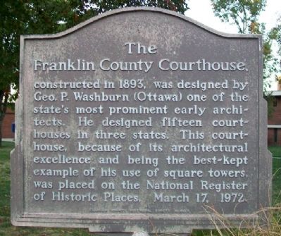
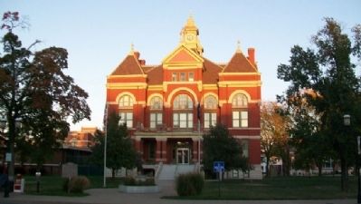
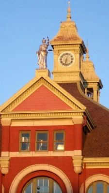
The Franklin County Courthouse
Erected by Franklin County Historical Society.
Topics. This historical marker is listed in these topic lists: Architecture • Government & Politics. A significant historical date for this entry is March 17, 1912.
Location. 38° 36.81′ N, 95° 16.105′ W. Marker is in Ottawa, Kansas, in Franklin County. Marker is on Main Street near 4th Street, on the left when traveling south. Touch for map. Marker is in this post office area: Ottawa KS 66067, United States of America. Touch for directions.
Other nearby markers. At least 8 other markers are within walking distance of this marker. Main Street, 400 Block South (within shouting distance of this marker); a different marker also named Franklin County Courthouse (about 300 feet away, measured in a direct line); The Down Town Ottawa Historic District (about 600 feet away); Pickrell Building (about 700 feet away); Main Street, 500 Block South and City Park (about 700 feet away); Shepherd & McQuesten Building (about 700 feet away); Main Street, 200 Block South (about 800 feet away); Civil War Memorial (approx. 0.2 miles away). Touch for a list and map of all markers in Ottawa.
Related marker. Click here for another marker that is related to this marker.
Also see . . .
1. Franklin County Courthouse National Register Nomination. (Submitted on April 16, 2012, by William Fischer, Jr. of Scranton, Pennsylvania.)
2. Franklin County, Kansas. (Submitted on April 16, 2012, by William Fischer, Jr. of Scranton, Pennsylvania.)
3. George P. Washburn. (Submitted on April 16, 2012, by William Fischer, Jr. of Scranton, Pennsylvania.)
Credits. This page was last revised on September 9, 2020. It was originally submitted on April 16, 2012, by William Fischer, Jr. of Scranton, Pennsylvania. This page has been viewed 509 times since then and 13 times this year. Photos: 1, 2, 3. submitted on April 16, 2012, by William Fischer, Jr. of Scranton, Pennsylvania.


