Stevens Point in Portage County, Wisconsin — The American Midwest (Great Lakes)
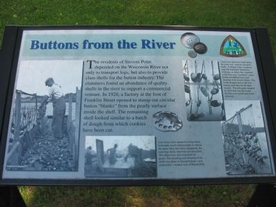
Buttons from the River
Clams were picked by hand where the water was shallow enough to wade. In deeper water, clammers used flat bottomed “johnboats,” with bars on either side. Attached to the bars were “crowfeet,” small hooks resembling bird’s feet dangling from several chains. The hooks dragged across the river bottom until they hit the open mussel. Then the clam snapped its shell shut over the hooks, the bars were raised and clams removed.
Live clams were steamed in long metal bottomed, wood-sided troughs to expose the meat. Once the clams opened up, the meat was easily removed and discarded. The clams were also examined for pearls. The steaming and cleaning of the shells was done on Second Island – now underwater – located west of Bukolt Park.
Erected by Stevens Point Parks, Recreation, and Forestry Department.
Topics. This historical marker is listed in this topic list: Industry & Commerce. A significant historical year for this entry is 1920.
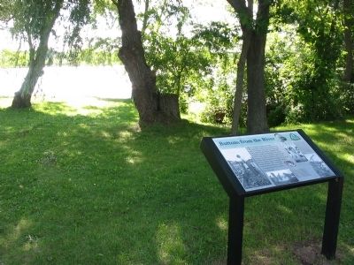
Location. 44° 31.631′ N, 89° 35.756′ W. Marker is in Stevens Point, Wisconsin, in Portage County. Marker is on Franklin Street, 0.2 miles west of Forest Street when traveling west. Marker is near the Wisconsin River by the northwest corner of Pfiffner/Pioneer Park. Touch for map. Marker is in this post office area: Stevens Point WI 54481, United States of America. Touch for directions.
Other nearby markers. At least 8 other markers are within 2 miles of this marker, measured as the crow flies. Stevens Point — Gateway to the Pineries (approx. half a mile away); Saint Peter Church War Memorial (approx. half a mile away); Airborne Forces Memorial Bridge (approx. half a mile away); Public Square (approx. 0.6 miles away); First Public Building (approx. 0.7 miles away); Portage County Civil War Memorial (approx. 0.9 miles away); The Boy with the Leaking Boot (approx. 1.1 miles away); St. Stanislaus Church World War II Memorial (approx. 1.4 miles away). Touch for a list and map of all markers in Stevens Point.
Credits. This page was last revised on June 16, 2016. It was originally submitted on February 17, 2008, by Keith L of Wisconsin Rapids, Wisconsin. This page has been viewed 1,357 times since then and 29 times this year. Photos: 1, 2. submitted on February 17, 2008, by Keith L of Wisconsin Rapids, Wisconsin. • J. J. Prats was the editor who published this page.

