Tomales in Marin County, California — The American West (Pacific Coastal)
Warren Dutton House - Tomales Community Park
Inscription.
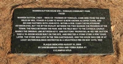
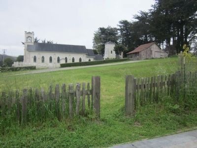
Warren Dutton, (1823-1903) co-founder of Tomales, came here from the gold fields in 1852, staked a claim to what is now known as Upper Town, and became partners with John Keys. Within a few years the relationship deteriorated, but the bitter rivalry between the two marked the progress of the town. The fence between the park and the field next to the Catholic Church marks the original line between Keys’ and Dutton’s properties.
In 1857 Mr. Dutton had a 14-room house built on this site, and erected a stone store a few years later. The store was lost in the 1906 Earthquake, and the house was one of at least sixteen buildings destroyed in a disastrous fire on May 24, 1920.
Erected 2008 by By Sam Brannan #1004 and Yerba Buena #1 E Clampus Vitus.
Topics and series. This historical marker is listed in these topic lists: Agriculture • Settlements & Settlers. In addition, it is included in the E Clampus Vitus series list. A significant historical month for this entry is May 1945.
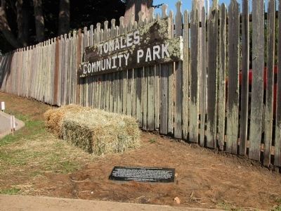
Location. 38° 14.736′ N, 122° 54.308′ W. Marker is in Tomales, California, in Marin County. Marker can be reached from Shoreline Highway (State Highway 1) south of Dillon Beach Road, on the right when traveling south. The marker is located at the Tomales Community Park which is just north of the Catholic Church. Touch for map. Marker is in this post office area: Tomales CA 94971, United States of America. Touch for directions.
Other nearby markers. At least 8 other markers are within 8 miles of this marker, measured as the crow flies. Tomales (within shouting distance of this marker); Tomales Presbyterian Church (about 500 feet away, measured in a direct line); Tomales Town Hall (about 700 feet away); Christo’s Running Fence (approx. 5.1 miles away); Stormy's (approx. 5˝ miles away); "Dos Piedras" (approx. 6.1 miles away); Beryl and Leonard Buck Hall (approx. 7.2 miles away); Getting to Marconi (approx. 7.2 miles away). Touch for a list and map of all markers in Tomales.
Also see . . . History of the Dutton Ranch. Ranch website entry (Submitted on May 4, 2012.)
Additional commentary.
1. Additional Information Regarding the Marker Dedication
Dale Welsh was Noble Grand Humbug when this plaque was dedicated. Plaque wording by Loren A. Wilson.
— Submitted April 23, 2012, by Loren Wilson of Sebastopol, California.
2. A Brief Biography of Warren Dutton
Warren Dutton, co-founder of Tomales, was born in Canada in 1823 and died in 1903. Warren came to San Francisco in August of 1849 and spent the next two to three years in the mines of the Mother Lode. He came here from the gold fields in 1852 and staked a claim to a piece of land to the north of that which was claimed by John Keyes.
As Clampers, we know that by 1852 the brotherhood of E Clampus Vitus was established throughout the diggings and perhaps Warren Dutton had been taken into our fraternal brotherhood during the time he spent in the mining camps; at least he probably was aware of the existence of the order. Once here, he became a partner of John Keyes, who had been here two years longer and who owned the southern part of what is now the Town of Tomales. The partnership did not last long due to the strong personalities of these two entrepreneurs, and in 1857, amid much acrimony, these two pioneers of Tomales dissolved their partnership and became enemies and competitors.
Dutton’s claim, which began at the fence between the Catholic Church parking lot and this park is, to this day known as Upper Town, and that which was originally owned by John Keyes is called Lower Town. It has been noted that the “bitter rivalry between the two marked the progress of the town.”
In 1857 Warren Dutton had a 14 room house built on this spot and erected a stone store, just to the north, a few years later. The stone store was a casualty of the 1906 Earthquake and his grand house was destroyed in a disastrous fire on May 24, 1920 which also claimed at least 16 buildings.
This Tomales pioneer was a banker who became something of a political power; he served on the State Board of Equalization, and later established himself as a fruit grower. In his travels through California, Warren Dutton had become interested in growing French Prunes which had a high fruit pulp to pit ratio and made an excellent dried fruit.
In March of 1881, Dutton acquired a 200 acre ranch a mile and one-half south west of Santa Rosa, and approached Luther Burbank and asked him if he could supply him with 20,000 prune trees by fall. Initially, Burbank was dismissive of the idea, but after thinking it over he agreed to try. By using almond seedlings as rootstock and grafting techniques he developed, Burbank was able to deliver 19,500 trees to Dutton’s Ranch by December 1st. This feat established Burbank as “The Plant Wizard” and Warren Dutton’s experiment and foresight marked the beginning of a 90 year period in which prunes became a leading crop in Sonoma County.
His memory lives on in Santa Rosa with a street, Dutton Avenue, which runs through what was once his ranch named after him, and he is remembered here in Tomales, as a co-founder of the town, with this plaque.
Loren Wilson NGH #10
September 31, 2008
— Submitted April 23, 2012, by Loren Wilson of Sebastopol, California.
Credits. This page was last revised on January 18, 2022. It was originally submitted on April 23, 2012, by Loren Wilson of Sebastopol, California. This page has been viewed 862 times since then and 53 times this year. Photos: 1. submitted on July 5, 2012, by Loren Wilson of Sebastopol, California. 2. submitted on April 23, 2012, by Loren Wilson of Sebastopol, California. 3. submitted on April 26, 2013. • Syd Whittle was the editor who published this page.


