Near Nyack in Placer County, California — The American West (Pacific Coastal)
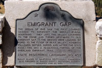
Emigrant Gap
State Registered Landmark No. 403
Tablet placed by California Centennials Commission. Base furnished by Placer County Historical Society
Dedicated June 25, 1950.
Erected 1950 by California Centennials Commission and Placer County Historical Society. (Marker Number 403.)
Topics and series. This historical marker is listed in these topic lists: Landmarks • Roads & Vehicles • Settlements & Settlers. In addition, it is included in the California Historical Landmarks series list. A significant historical date for this entry is June 25, 1933.
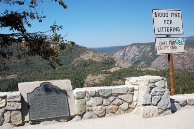
Location. 39° 17.955′ N, 120° 40.369′ W. Marker is near Nyack, California, in Placer County. Marker is on Highway 80 (Interstate 80), on the right when traveling west. Marker is at a Scenic Vista parking area on the highway. Touch for map. Marker is in this post office area: Emigrant Gap CA 95715, United States of America. Touch for directions.
Other nearby markers. At least 5 other markers are within 6 miles of this marker, measured as the crow flies. A different marker also named Emigrant Gap (approx. 0.6 miles away); Nyack Lodge (approx. 0.6 miles away); Nevada City Road - Washington Ridge Summit (approx. 4.4 miles away); Alpha and Omega (approx. 4.4 miles away); Ormonde (approx. 5.8 miles away).
Credits. This page was last revised on July 14, 2019. It was originally submitted on September 27, 2006, by Karen Key of Sacramento, California. This page has been viewed 5,025 times since then and 235 times this year. Photos: 1, 2, 3. submitted on September 27, 2006, by Karen Key of Sacramento, California. • J. J. Prats was the editor who published this page.


