Near Lubec in Washington County, Maine — The American Northeast (New England)
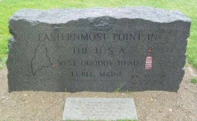
Easternmost Point in the U.S.A.
44°48"9'N 66°57"1'W
Erected by the WQHLKA Inc.
Spring 2005
with permission of the
Maine Department
of Conservation
Erected 2005 by the WQHLKA Inc.
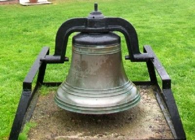
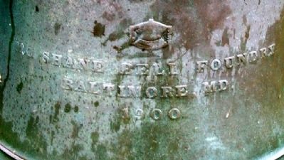
Topics and series. This historical marker is listed in this topic list: Notable Places. In addition, it is included in the Historic Bells, and the Lighthouses series lists. A significant historical year for this entry is 2005.
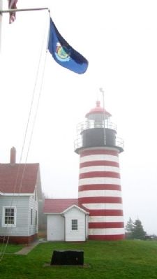
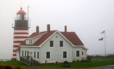
Location. 44° 48.901′ N, 66° 57.035′ W. Marker is near Lubec, Maine, in Washington County. Marker is on the grounds of the West Quoddy Head Lighthouse, in Quoddy Head State Park, at the east end of Quoddy Head Road. Touch for map. Marker is in this post office area: Lubec ME 04652, United States of America. Touch for directions.
Other nearby markers. At least 8 other markers are within 6 kilometers of this marker, measured as the crow flies. Lubec Veterans Honor Roll (approx. 3.6 miles away); Civil War Memorial (approx. 3.6 miles away); Lubec, Maine (approx. 3.6 miles away in Canada); a different marker also named Lubec, Maine (approx. 5.8 kilometers away in Canada); War Memorial (approx. 5.8 kilometers away); Mulholland Point / La pointe Mulholland (approx. 5.8 kilometers away in Canada); Dawn's First Light Shines on Free Masonry (approx. 5.8 kilometers away); First Meeting Place of Washington Lodge No. 37 F.&A.M. (approx. 5.9 kilometers away). Touch for a list and map of all markers in Lubec.
Credits. This page was last revised on November 2, 2020. It was originally submitted on April 24, 2012, by William Fischer, Jr. of Scranton, Pennsylvania. This page has been viewed 1,152 times since then and 83 times this year. Photos: 1. submitted on April 24, 2012, by William Fischer, Jr. of Scranton, Pennsylvania. 2. submitted on February 25, 2016, by Don Morfe of Baltimore, Maryland. 3, 4, 5, 6, 7. submitted on April 24, 2012, by William Fischer, Jr. of Scranton, Pennsylvania.
