Clemson in Pickens County, South Carolina — The American South (South Atlantic)
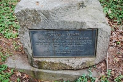
Hopewell, Keowee
Home of General Andrew Pickens
Erected 1976 by Foundation for Historic Restoration in the Pendleton Area.
Topics. This historical marker is listed in this topic list: Native Americans. A significant historical year for this entry is 1765.
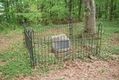
Location. 34° 39.367′ N, 82° 50.517′ W. Marker is in Clemson, South Carolina, in Pickens County. Marker can be reached from West Cherry Road. Marker is located at the end of a trail about 1/4 mile from the Hopewell roadside marker. Touch for map. Marker is in this post office area: Pickens SC 29671, United States of America. Touch for directions.
Other nearby markers. At least 10 other markers are within 2 miles of this marker, measured as the crow flies. Hopewell Treaty Site (here, next to this marker); Hopewell Plantation (approx. ¼ mile away); Hopewell / Hopewell Indian Treaties (approx. 0.3 miles away); The Battle of Seneca Town / Fort Rutledge (approx. ¾ mile away); Site of Fort Rutledge (approx. one mile away); "Widowmaker’s” Drill (approx. 1.2 miles away); Cherokee Town of Esseneca (approx. 1.3 miles away); Fort Hill Slave Quarters / Clemson College Convict Stockade (approx. 1.4 miles away); Asbury F. Lever (approx. 1.4 miles away); Calhoun Plantation Cemetery (approx. 1.4 miles away). Touch for a list and map of all markers in Clemson.
Additional commentary.
1. Treaty Oak
On the grounds of Hopewell stood an oak under which was signed the Treaty of Hopewell, negotiated in 1785 by General Pickens with several Indian tribes. By this treaty the aborigines, who had no understanding of land ownership, surrendered their rights to about one third each of Georgia and Tennessee, North Carolina west of the Blue Ridge, and to the present counties of Oconee, Anderson, Pickens, and Greenville in South Carolina. Representatives of the other areas concerned and some 1,000 Indians, including 37 chiefs, attended the council, which lasted 10 days. One provision of the treaty led to the exchange of Anna Calhoun, a relative of the statesman, who was a prisoner of the Indians. "Treaty Oak" stood for more than 100 years after it had sheltered the council. After its decay, one sound limb was used by Mrs. Mary Cherry Doyle, owner of the place, for making gavels that were presented to various chapters of the D.A.R. (Source: South Carolina: A Guide to the Palmetto State by Federal Writers Project (1976), pg. 443.)
— Submitted April 28, 2012, by Brian Scott of Anderson, South Carolina.
Credits. This page was last revised on March 12, 2019. It was originally submitted on April 28, 2012, by Brian Scott of Anderson, South Carolina. This page has been viewed 814 times since then and 39 times this year. Photos: 1, 2, 3, 4, 5. submitted on April 28, 2012, by Brian Scott of Anderson, South Carolina.


