Greenbrier West in Chesapeake, Virginia — The American South (Mid-Atlantic)
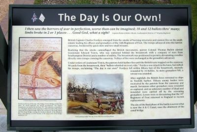
The Day is Our Own!
British Captain Charles Fordyce emerged from the smoke of burning structures and cannon fire on the south island, leading his officers and grenadiers of the 14th Regiment of Foot. The troops advanced onto the narrow causeway, bordered by quick mire and two small streams.
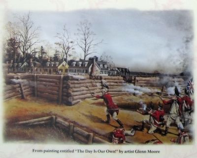
Realizing that the smoke camouflaged the British movements, patriot Colonel Thomas Bullett alerted Lieutenant Edward Travis, who was stationed behind the breastwork with a company of men from Southampton District and a number of militia. The breastwork was positioned to permit a devastating crossfire directly onto troops crossing the causeway. Volleys of fire were exchanged as the grenadiers advanced.
Under orders of Lieutenant Travis, the patriots held further fire until the British were trapped on the causeway 50 yards from the breastwork, then “bullets whistled on every side.” Fordyce was struck in the knee, but rallied his troops, exclaiming “The day is our own!” Fordyce fell within fifteen feet of the breastwork, mortally wounded by 14 bullets. As more grenadiers fell, a retreat was sounded.
After nightfall, the British force retreated to ships in Norfolk harbor. Fifteen enemy bodies were recovered by the patriots from the causeway and marsh. Seventeen other grenadiers were wounded or captured, and an unknown number of dead and wounded were carried off by the retreating grenadiers. Losses were so devastating that the 14th Regiment of Foot returned to England to recruit replacements.
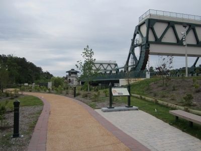
The site of the final phase of the battle is across what is now the A & C Canal, near the abutment of the canal bridge.
Erected 2012 by Great Bridge Battlefield & Waterways History Foundation.
Topics. This historical marker is listed in this topic list: War, US Revolutionary.
Location. 36° 43.305′ N, 76° 14.384′ W. Marker is in Chesapeake, Virginia. It is in Greenbrier West. Marker can be reached from the intersection of North Battlefield Boulevard (Business Virginia Route 168) and Watson Road, on the left when traveling south. Touch for map. Marker is in this post office area: Chesapeake VA 23320, United States of America. Touch for directions.
Other nearby markers. At least 8 other markers are within walking distance of this marker. Site of the Original Causeway (a few steps from this marker); Causeway Construction (within shouting distance of this marker); First Fire (within shouting distance of this marker);

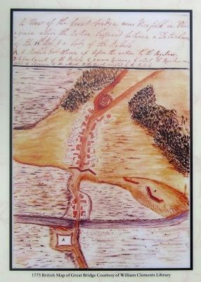
2. 1775 British Map of Great Bridge Courtesy of William Clements Library
South is at the top of the map. The Village of Great Bridge is below the letter “D” which identifies the Patriot encampment. The Patriot breastworks are marked by the letter “B.” The causeway is marked as “C.” The upper portion of the causeway is today’s location of the A & C Canal and the modern bridge. Below the causeway is the South Island and the Great Bridge crossing the Southern Branch of the Elizabeth River. Fort Murray is at the bottom of the map north of the bridge marked as “A.”
Also see . . . Great Bridge Battlefield & Waterways History Foundation. (Submitted on April 29, 2012, by Bernard Fisher of Richmond, Virginia.)
Credits. This page was last revised on February 1, 2023. It was originally submitted on April 29, 2012, by Bernard Fisher of Richmond, Virginia. This page has been viewed 1,019 times since then and 37 times this year. Photos: 1, 2, 3, 4. submitted on April 29, 2012, by Bernard Fisher of Richmond, Virginia.


