Near Welshpool in Charlotte County, New Brunswick — The Atlantic Provinces (North America)
Lubec, Maine
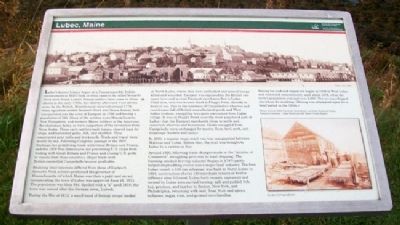
Lubec's known history began at a Passamaquoddy Indian encampment at Mill Creek in what came to be called Seward's Neck (now North Lubec). French settlers later came to those shores in the early 1700s, but shortly afterward were driven away by the British. Resettlement occurred around 1776 when squatters settled Seward's Neck and Moose Island, both incorporated into the town of Eastport in 1798 and having a population of 244. Many of the settlers were Massachusetts, New Hampshire, and western Maine soldiers in the American Revolutionary Army, or were supporters of the revolution from Nova Scotia. These early settlers built homes, cleared land for crops, and harvested game, fish, and shellfish. They constructed grist mills and brickyards. Trade and travel were mostly by sea. Following Congress' passage of the 1807 Embargo Act prohibiting trade with Great Britain and France, and the 1809 Non-Intercourse Act preventing U.S. ships from trading with Great Britain and France and closing U.S. ports to vessels from those countries, illegal trade with British-controlled Campobello became profitable.
Realizing their interests differed from those of Eastport, Seward's Neck settlers petitioned the governor of Massachusetts (of which Maine was then a part) and an act incorporating the town of Lubec was approved June 21, 1811. The population was then 584. Spelled with a "k" until 1818, the town was named after the German town, Lubeck.
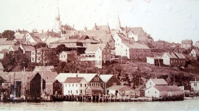
During the War of 1812, a small band of British troops landed at North Lubec, where they were ambushed and several troops killed and wounded. Eastport was captured by the British two years later and several Eastport merchants fled to Lubec. Until then, only two houses stood at Flagg's Point, directly in front of you. Due to the nearness of Campobello's wharves and storehouses full of British manufactured goods and West Indies produce, smuggling was quite convenient from Lubec village. It was at Flagg's Point (now the more populated part of Lubec) that the Eastport merchants chose to settle and construct wharves and businesses. Goods smuggled from Campobello were exchanged for money, flour, beef, pork, and cooperage (barrels and casks).
In 1820, a regular stage coach run was inaugurated between Machias and Lubec. Before that, the mail was brought to Lubec by a carrier on foot.
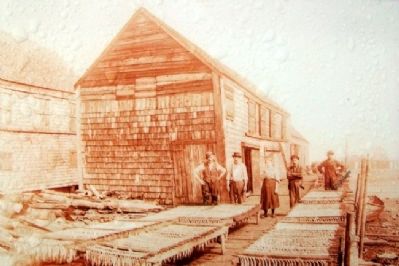
Around 1820, following trade changes made in the "Articles of Comerce", smuggling gave way to legal shipping. The booming smoked herring industry (begun in 1797) partly helped shipbuilding evolve into a major local industry. The first Lubec vessel, a 120-ton schooner, was built in North Lubec in 1804; construction of over 140 merchant vessels at twelve different sites followed . Lubec-built
vessels, captained and crewed by Lubec men carried herring, salt and pickled fish, hay, potatoes, and lumber to Boston, New York, and Philadelphia, returning with coal, flour, fruit and spices, molasses, sugar, rum, and general merchandise.
Mining for lead and copper ore began in 1828 in West Lubec and continued intermittently until about 1878, when the town's population was just over 2,000. The ore was shipped elsewhere for smelting. (Mining was attempted again for a brief period in the 1950s.)
——————
Photos courtesy Edith Comstock, Helen Burns, and Lubec Historical Society
Historical resources: Lubec Herald and 200 Years of Lubec History
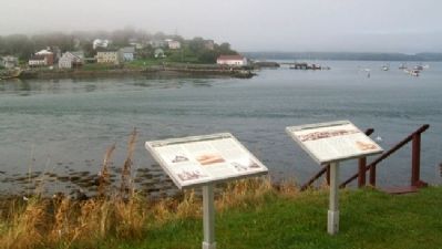
Erected by Roosevelt Campobello International Park.
Topics. This historical marker is listed in these topic lists: Industry & Commerce • Settlements & Settlers • Waterways & Vessels. A significant historical date for this entry is June 21, 1790.
Location. 44° 51.785′ N, 66° 58.761′ W. Marker is near Welshpool, New Brunswick, in Charlotte County. Marker is on the grounds of Mulholland Point Lighthouse, off Narrows Road, and about 0.5 kilometers north of the FDR Memorial Bridge, in Roosevelt Campobello International Park. Touch for map. Marker is in this post office area: Welshpool NB E5E 1A4, Canada. Touch for directions.
Other nearby markers. At least 8 other markers are within walking distance of this marker. A different marker also named Lubec, Maine (here, next to this marker); Mulholland Point / La pointe Mulholland (a few steps from this marker); First Meeting Place of Washington Lodge No. 37 F.&A.M. (approx. 0.4 kilometers away in the U.S.); Civil War Memorial (approx. half a kilometer away in the U.S.); Lubec Veterans Honor Roll (approx. half a kilometer away in the U.S.); War Memorial (approx. half a kilometer away in the U.S.); Dawn's First Light Shines on Free Masonry (approx. half a kilometer away in the U.S.); Roosevelt Campobello International Park (approx. 1.6 kilometers away). Touch for a list and map of all markers in Welshpool.
More about this marker. An identical French-language marker is nearby.
Also see . . . Lubec: A Border Town Shaped by the Sea. (Submitted on May 3, 2012, by William Fischer, Jr. of Scranton, Pennsylvania.)
Credits. This page was last revised on August 16, 2017. It was originally submitted on May 2, 2012, by William Fischer, Jr. of Scranton, Pennsylvania. This page has been viewed 1,448 times since then and 51 times this year. Photos: 1, 2, 3, 4. submitted on May 3, 2012, by William Fischer, Jr. of Scranton, Pennsylvania.


