St. Simons Island in Glynn County, Georgia — The American South (South Atlantic)
North Atlantic Right Whale
Mother and Calf
Georgia's State Marine Mammal
Photographed by Mike Stroud, January 26, 2012
1. North Atlantic Right Whale Marker
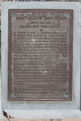
In February of 1984, an expedition launched from St. Simons Island discovered the calving grounds of the North Atlantic Right Whale. Female whales give birth in nearby coastal waters during the winter months; But the young calves and their mothers are in great danger - many are killed in collisions with oceangoing vessels, and others die of unknown causes. Even as Keith Jennings fashioned this sculpture in the fall and winter of 1995, there were at least six mortalities. Now, there are fewer than 300 right whales left.
This plaque is presented by the Ocean Society in appreciation to the Whales in the Park Committee, the Glynn County Board of Commissioners, Golden Isles Arts and Humanities Association, sculptor Keith Jennings, and the people of Glynn County for their continuing efforts to protect this critical coastal habitat and to raise awareness of the plight of the North Atlantic Right Whale.
For it is in these waters that the destiny of the world's most endangered whale will be written.
Topics. This historical marker is listed in these topic lists: Animals • Environment. A significant historical month for this entry is February 1984.
Location. 31° 8.034′ N, 81° 23.677′ W. Marker is on St. Simons Island, Georgia, in Glynn County. It can be reached from Beach View Drive. Located near Beachview Drive at the Atlantic Ocean. Touch for map. Marker is in this post office area: Saint Simons Island GA 31522, United States of America. Touch for directions.

Regionally, this marker is on the Coastal Plain, on the Georgia Coast and the Golden Isles, and on the Sea Islands. It is also in the American South, specifically in the Deep South, and on the Eastern Seaboard. Globally, it is in the North Atlantic Region, North America, the Western Hemisphere, the Western World, and the Anglosphere.
this page online
Other nearby markers. At least 8 other markers are within walking distance of this marker: Fort St. Simons (within shouting distance of this marker); The First Lighthouse ~ 1810 (about 300 feet away, measured in a direct line); The Historic St. Simons Light Station (about 300 feet away); Early History of St. Simons Island (about 300 feet away); Historic St. Simons Lighthouse (about 300 feet away); a different marker also named Fort St. Simons (about 400 feet away); Couper's Point (about 400 feet away); a different marker also named Fort St. Simons (about 400 feet away). Touch for a list and map of all markers in St. Simons Island.
Regarding North Atlantic Right Whale. The North Atlantic right whale is usually found in temperate waters, although some move just north of the Arctic Circle or just south of the Tropic of Cancer. It is found closer to land than are most large whales, especially during the breeding season.
Photographed by Mike Stroud, January 26, 2012
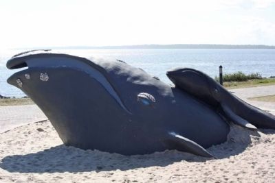
2. North Atlantic Right Whale - Keith Jennings sculpture
Also see . . . Right whale, from Wikipedia. ...A popular explanation for the name "right whales" is that they were the "right" ones to hunt, as they float when killed and often swim within sight of shore.... (Submitted on May 3, 2012, by Mike Stroud of Bluffton, South Carolina.)
Photographed by Mike Stroud, January 26, 2012
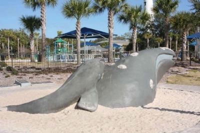
3. North Atlantic Right Whale Marker, seen at left
Photographed by Mike Stroud, January 26, 2012
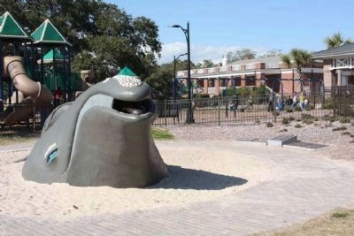
4. North Atlantic Right Whale Marker, at right
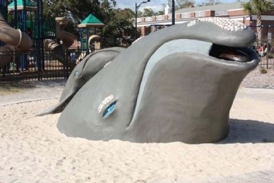
Photographed by Mike Stroud, January 26, 2012
5. North Atlantic Right Whale
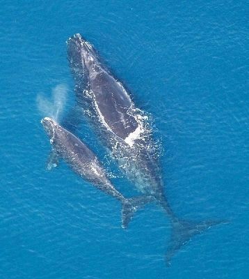
Wikipedia, Adapted from materials provided by Dalhousie University.
6. North Atlantic Right Whale
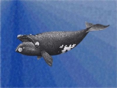
Photographed by Carnivora
7. North Atlantic Right Whale
Credits. This page was last revised on November 25, 2020. It was originally submitted on May 3, 2012, by Mike Stroud of Bluffton, South Carolina. This page has been viewed 1,126 times since then and 35 times this year. Photos: 1, 2. submitted on May 3, 2012, by Mike Stroud of Bluffton, South Carolina. 3, 4. submitted on May 4, 2012, by Mike Stroud of Bluffton, South Carolina. 5, 6, 7. submitted on May 3, 2012, by Mike Stroud of Bluffton, South Carolina.
